-
E-mail
1591259053@qq.com
-
Phone
15666889209
-
Address
Room 207, Building 1, Weifang High tech Zone Optoelectronic Industry Accelerator (Phase I), No. 155 Optical Circuit, Weifang High tech Zone, Shandong Province
Shandong Jingdao Optoelectronics Technology Co., Ltd
Real time monitoring system for urban waterlogging: emergency response linkage to enhance urban flood prevention capabilities
Date: 2025-12-22Read: 5
【JD-JS1】, Shandong Jingdao Optoelectronics, customer-centric and quality-oriented, work together for a win-win future.
In the process of urban development, urban waterlogging has become an important issue affecting urban safety and normal operation. During the j end weather such as rainstorm, waterlogging will not only interfere with the daily life of residents, but also may pose a threat to infrastructure, economic activities and even the safety of residents. The real-time monitoring system for urban waterlogging and waterlogging is becoming a key support for improving urban flood prevention capabilities through emergency response linkage mechanisms.
Real time monitoring: Accurately grasp the dynamics of waterlogging and waterlogging
Comprehensive monitoring network coverage
The real-time monitoring system for urban waterlogging relies on widely distributed monitoring stations to build a comprehensive monitoring network. These monitoring stations are distributed in various key areas of the city, including low-lying areas, underground passages, drainage network nodes, and locations where rivers and urban water systems intersect and are prone to waterlogging. Each monitoring station is equipped with multiple types of sensors, such as water level sensors for real-time measurement of water depth, rainfall sensors for accurate recording of rainfall amount and intensity, and flow rate sensors for monitoring water flow velocity. Through these sensors, the system can obtain key data and information on urban waterlogging in real-time, providing accurate basis for subsequent analysis and decision-making. For example, in urban commercial areas, due to dense population and frequent commercial activities, the impact of waterlogging is significant once it occurs. Therefore, multiple monitoring stations should be set up in and around the area to ensure accurate monitoring of the waterlogging situation in the region.
Real time data collection and transmission
The system has efficient real-time data collection and transmission capabilities. The sensors at each monitoring station quickly collect relevant data at set time intervals, such as every few minutes or even shorter. The collected data is quickly transmitted to the data processing center through wired or wireless communication methods such as fiber optic, 4G, NB IoT, etc. During the transmission process, advanced data encryption technology is used to ensure the security and integrity of the data, preventing it from being stolen or tampered with. After receiving the data, the data processing center immediately organizes and conducts preliminary analysis to ensure the accuracy and availability of the data. For example, in the process of a rainstorm, the real-time data collected by each monitoring station can be transmitted to the data processing center in a short time, providing strong support for timely mastering the dynamics of waterlogging.
Data Visualization and Analysis
In order to facilitate relevant personnel to intuitively understand the situation of waterlogging, the system will visualize the collected data. Through geographic information system (GIS) technology, monitoring data is presented in map form, and information such as water depth and rainfall in different regions is visually displayed through colors, icons, and other methods. At the same time, the system can also generate various data charts, such as water level change curves, rainfall trend charts, etc., clearly presenting the changes in waterlogging over time. In addition, using data analysis algorithms, the system can compare and analyze historical data with real-time data, predict the development trend of waterlogging, and provide scientific basis for flood control decisions. For example, by analyzing the waterlogging situation in the same area under similar rainfall conditions in the past few years, combined with real-time monitoring data, the possible depth and impact range of this waterlogging can be predicted.
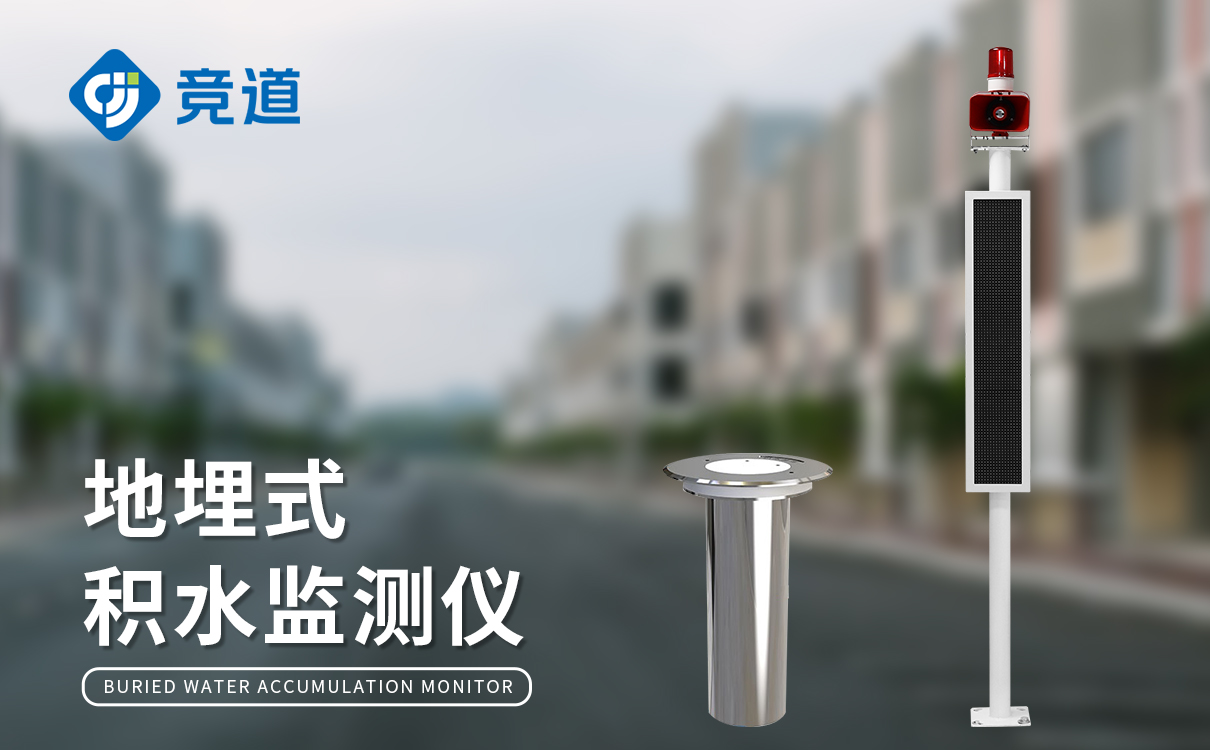
Emergency response linkage: collaborative response to the crisis of waterlogging and waterlogging
Collaboration and linkage between departments
The real-time monitoring system for urban waterlogging has achieved emergency response linkage among multiple relevant departments. When the system detects that the risk of waterlogging has reached a certain level, it will immediately send warning information to relevant departments such as urban management departments, flood control command centers, transportation departments, fire departments, and drainage companies. Each department quickly activated emergency plans based on warning information and coordinated response work. For example, urban management departments organize personnel to inspect and clear drainage facilities in areas prone to water accumulation, ensuring smooth drainage; The flood control command center coordinates resources from all parties and formulates overall response strategies; The transportation department implements traffic control in areas with severe waterlogging, guides vehicles to detour, and ensures traffic safety; The firefighting department is on standby at all times to respond to emergency situations such as personnel being trapped; The drainage company will increase its drainage efforts, open drainage pump stations and other facilities, and quickly reduce the accumulated water level. Through the collaborative linkage of various departments, a strong force is formed to deal with waterlogging and waterlogging.
Efficient allocation of resources
During the emergency response process, the system can assist in achieving efficient allocation of resources. Based on real-time monitoring data and development trends of waterlogging, the flood control command center can accurately determine the degree of disaster and resource demand in each region, and thus allocate human and material resources reasonably. For example, in areas with deep water accumulation and wide impact, timely deployment of more drainage vehicles, emergency personnel, and flood prevention materials such as sandbags and pumping equipment should be carried out. At the same time, the system can also track the allocation and utilization of resources in real time, ensuring that resources can be timely and effectively invested in the places where they are most needed. For example, by installing positioning systems on mobile devices equipped with drainage vehicles and rescue personnel, real-time monitoring of their location and working status can be achieved, allowing for dynamic adjustments based on actual situations.
Public Information Release and Participation
The real-time monitoring system for urban waterlogging focuses on public information dissemination and participation. Through various channels such as ZF website, social media platform, SMS, APP, etc., timely release of waterlogging warning information, real-time dynamics, and response measures to the public. The public can use this information to understand the situation of waterlogging and waterlogging in their area, and make preparations in advance, such as avoiding areas with waterlogging and transferring important items. At the same time, the system also encourages the public to participate in the monitoring and feedback of waterlogging. The public can upload photos, videos, and other information of waterlogging in their location through the mobile app, providing a more comprehensive on-site situation for the system and helping relevant departments better grasp the dynamics of waterlogging and timely adjust response strategies.
Enhancing Urban Flood Control Capability: Ensuring Urban Safety in All Directions
Enhance the accuracy and timeliness of early warning
The real-time monitoring system for urban waterlogging greatly enhances the accuracy and timeliness of waterlogging warning through real-time and accurate monitoring data. The system can detect the risk of waterlogging in advance and issue different levels of warnings based on the degree of risk, allowing relevant departments and the public sufficient time to take response measures. Compared with traditional warning methods, this system no longer relies on a single data source or empirical judgment, but analyzes and predicts based on comprehensive and real-time monitoring data, effectively avoiding misjudgments and omissions. For example, before a rainstorm comes, the system sends an accurate waterlogging warning several hours in advance through real-time monitoring and analysis of rainfall, water level changes and other data. Relevant departments can make preparations for drainage equipment commissioning, personnel deployment and other work in advance, and the public can plan travel in advance to avoid the impact of waterlogging.
Optimize the scientificity of flood control decision-making
The rich data and analysis results provided by the system provide a scientific basis for flood control decision-making. Through in-depth analysis of historical and real-time monitoring data, relevant departments can better understand the patterns and characteristics of urban waterlogging, assess flood prevention risks in different regions, and develop more scientific and reasonable flood prevention plans. When dealing with waterlogging events, based on real-time data and prediction results, the flood control command center can make more accurate decisions, such as arranging the operation of drainage facilities reasonably, determining personnel and material allocation plans, etc. For example, when there is waterlogging in a certain area, the real-time water level, flow rate, and operation data of the surrounding drainage network provided by the system help the flood control command center accurately determine the direction and focus of drainage, scientifically allocate drainage forces, and effectively alleviate the situation of waterlogging.
Improve emergency response efficiency
The emergency response linkage mechanism has significantly improved the efficiency of emergency response to urban waterlogging. The coordination and efficient allocation of resources among various departments enable the rapid and orderly implementation of various measures to address waterlogging. In the shortest possible time, drainage facilities were activated, rescue personnel and supplies arrived at the scene, traffic was effectively diverted, and the impact of waterlogging on the city was reduced. For example, in a serious waterlogging event, through the emergency response linkage of various departments, drainage work was quickly carried out, traffic congestion was promptly alleviated, trapped persons were rescued in a timely manner, and the losses caused by waterlogging were reduced to a minimum.
The real-time monitoring system for urban waterlogging and waterlogging, through the emergency response linkage mechanism, enhances flood control capabilities from real-time monitoring and collaborative response to comprehensive improvement, providing strong support for urban response to waterlogging and waterlogging problems. With the continuous advancement of technology, this system will continue to improve and upgrade, playing a more important role in ensuring urban safety and sustainable development.