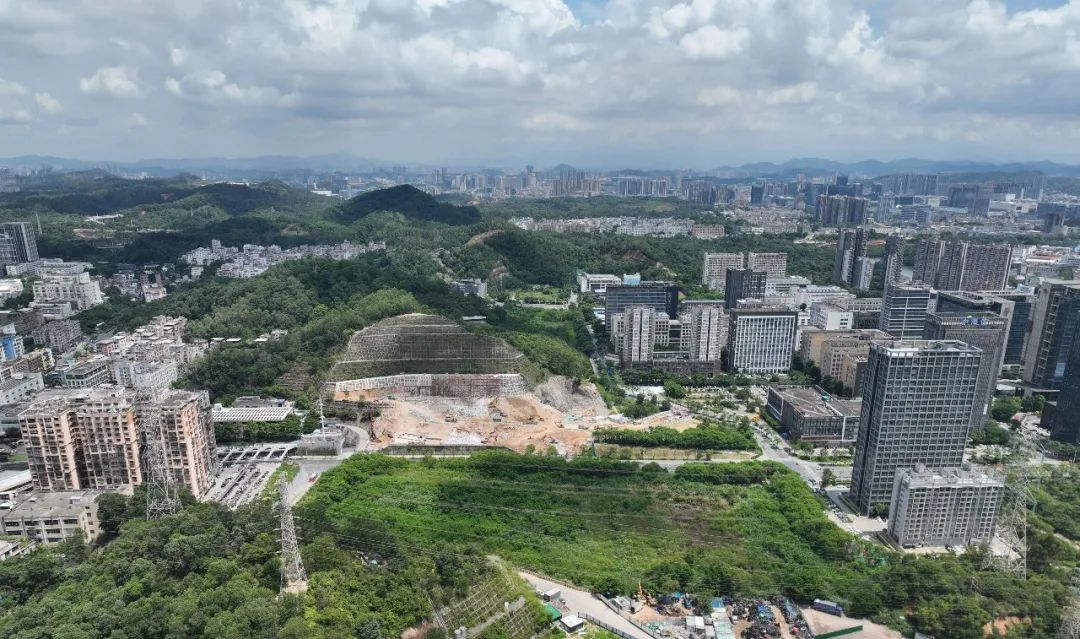
In the field of geographic information data collection, especially in mountainous areas with complex terrain and diverse environments, obtaining high-precision contour data models has always been a challenge. Traditional measurement methods are not only time-consuming and labor-intensive, but also difficult to carry out in some remote areas. However, with the rapid development of technology, the combination of drone technology and LiDAR provides innovative and efficient solutions to this problem.
1、 The Challenge of Topographic Mapping in Mountainous Areas
The complex terrain, large undulations, and dense vegetation in mountainous areas have posed great obstacles to traditional surveying and mapping work. In mountainous areas, manually carrying total stations, RTK and other equipment for data collection not only requires a lot of manpower, material resources and time, but also in some areas with steep terrain and difficult access for personnel, effective data collection is simply impossible. In addition, dense vegetation can obstruct the line of sight, making it impossible for optical cameras to penetrate the vegetation and obtain real topographic features, thereby affecting the accuracy of surveying data.
2、 Solution: DJI M400+L2 LiDAR system
As an industry level flagship flight platform, DJI M400 has many powerful functions, providing reliable support for contour data collection in mountainous areas.
Long endurance capability:After adding a load, the Matrice 400 can fly for up to 59 minutes and hover for up to 53 minutes, allowing the drone to perform long-term continuous operations in mountainous areas without frequent battery replacement or returning to the base for charging, greatly improving operational efficiency.Powerful obstacle avoidance system:With the help of an obstacle avoidance system consisting of a ring scanning laser radar, high-precision millimeter wave radar, and full-color low light fisheye vision sensor, the Matrice 400 can avoid large obstacles such as buildings and mountains at a flight speed of up to 25 meters per second, ensuring flight safety even in harsh environments such as nighttime or rainy and foggy weather. This feature is particularly important in complex mountainous terrain, as it can effectively avoid collisions between drones and obstacles, ensuring the smooth progress of data collection tasks.Intelligent homework function:Matrice 400 supports real-time ground simulation flight in any horizontal direction, ensuring consistent ground GSD resolution and obtaining high-precision mapping data during surveying operations. Through this function, the drone can automatically adjust its flight altitude based on the undulations of the terrain, maintaining a stable relative height to the ground, thereby obtaining more accurate and uniform surveying data.
Zenith L2 LiDAR integrates frame type LiDAR, high-precision self-developed pose system, and 4/3 CMOS visible light mapping camera, endowing the flight platform with precise, efficient, and reliable 3D data acquisition capabilities
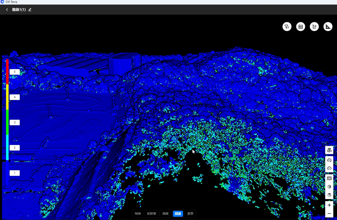
High precision data collection:Integrating GNSS and high-precision self-developed pose system, Zenith L2The elevation accuracy can reach 4 centimeters,The plane accuracy reaches 5 centimetersIn the process of collecting contour data in mountainous areas, such high accuracy can accurately reflect subtle changes in terrain, providing strong support for constructing high-precision contour data models.Efficient homework:Start up and start working, single flight can quickly obtain2.5 square kilometersPoint cloud data. Compared with traditional manual surveying methods, it greatly shortens the time for data collection and improves work efficiency. In large-scale mountainous surveying projects, it can significantly reduce project cycles and lower costs.High penetrability:The light spot area is small, the energy is more concentrated, the range is increased by 30%, reaching 250 meters (reflectivity 10%, 100 klx), 450 meters (reflectivity 50%, 0 klx), and the typical operating altitude can reach 150 meters.Supports up to 5 echoes and can penetrate denser vegetationObtain abundant understory ground points. This feature enables accurate acquisition of terrain data even in densely vegetated mountainous areas, making up for the shortcomings of traditional optical surveying methods.
3、 Practical case: Obtaining contour data from a mountainous area in Shenzhen
Using DJI M400 drone equipped with L2 LiDAR for contour data acquisition. The mountainous area has a high drop and dense vegetation, making it difficult to carry out traditional surveying and mapping methods.
workflow:
intelligent planningPlan the work area through M400 remote control
collect dataThe drone collects data at a speed of 15m/s, and the remote control can preview the point cloud in real time
point cloud processingOne stop data processing through DJI Smart Map software
-
Contour extractionGenerating contour lines through third-party software

|
Traditional manual methods |
|
|
Manually carrying equipment to collect data one by one is extremely inefficient. In complex mountainous terrain, the surveying area that can be completed in one day is very limited |
The single operation area can reach 2.5 square kilometers, and multiple sorties can be flown per day, enabling the completion of large-scale mountainous surveying tasks in a short period of time |
|
Due to limitations in personnel operations and terrain environment, data accuracy is difficult to guarantee in densely vegetated areas and hard to reach places |
The elevation accuracy can reach 4 centimeters, and the plane accuracy can reach 5 centimeters, which can obtain high-precision mountainous terrain data, including understory terrain |
|
In the steep terrain of mountainous areas, manual surveying faces many safety risks, such as falling, slipping, and being attacked by wild animals |
Drone flight operations prevent personnel from entering dangerous areas and ensure the safety of operators |
|
Requires a large amount of manpower, and the costs of equipment handling, manpower training, etc. are relatively high |
The investment in disposable equipment is relatively high, but in the long run, the improvement in operational efficiency greatly reduces the overall cost |
4Key points of technological breakthroughs
The Four Revolutionary Values of L2 Lidar:
True vegetation penetrationFive echo technology captures the true shape of the earth's surface
Night navigation capabilityActive laser achieves 24-hour surveying and mapping
No image control required:Integrated GNSS and high-precision self-developed pose system, with an elevation accuracy of 4cm and a plane accuracy of 5cm
-
Measurement distance:250 meters (reflectivity 10%, 100klx), 450 meters (reflectivity 50%, 0klx)
The DJI M400 drone is equipped with a combination of L2 LiDAR, providing an efficient, accurate, and safe new solution for obtaining contour data models in mountainous areas. Compared with traditional manual surveying methods, it has significant advantages in terms of operational efficiency, data accuracy, operational safety, and cost. With the continuous development of drone technology and LiDAR technology, it is believed that this combination will be widely applied in more geographic mapping projects, bringing new changes to the development of the geographic information industry.Drones and LiDARThe combination ofLet complex terrain surveying officially enter the "automated centimeter era"! Contact us for a complete technical solution!