Top 10 Chinese Polyacrylamide Brands Worth Knowing: An Industry Overview
09,21,2026 14 views


11,17,20251From:
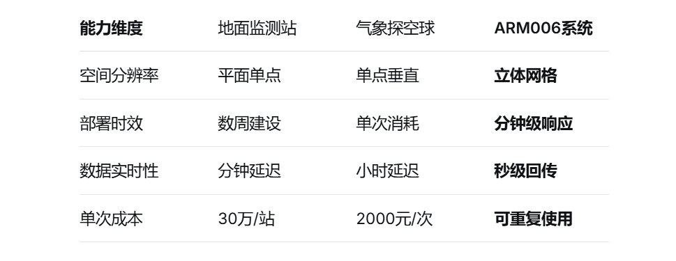
Traditional meteorological monitoring is limited by fixed points, making it difficult to capture complete atmospheric activity like a "blind man touching an elephant".ARM006 Unmanned Aerial Vehicle Meteorological Monitoring SystemInnovative construction based on DJI flight platformIntegrated monitoring network of air, space, and earthRealize three-dimensional data collection from the surface to a height of kilometers.
This system has made a breakthrough inVisibility, temperature and humidity, air pressure, wind speed and directionUpgrade the monitoring of core meteorological elements to a three-dimensional dimension:
High altitude detection:50-1500 meter gradient meteorological data collection
Dynamic tracking:Real time capture of key meteorological phenomena such as inversion layer and wind shear
Global coverage:Obstacle free monitoring of complex terrain to compensate for blind spots in ground station networks
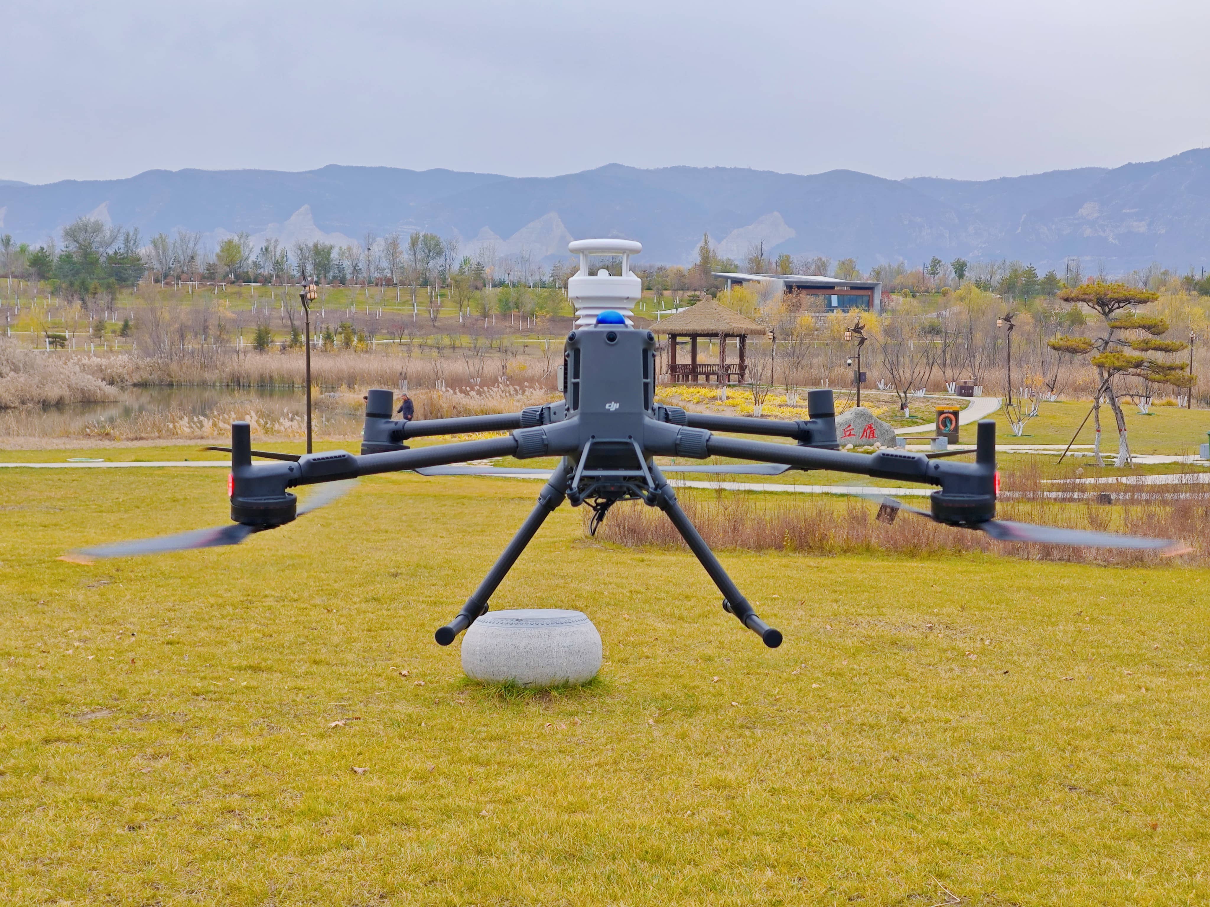
Intelligent sensing matrix integrates multiple innovative technologies:
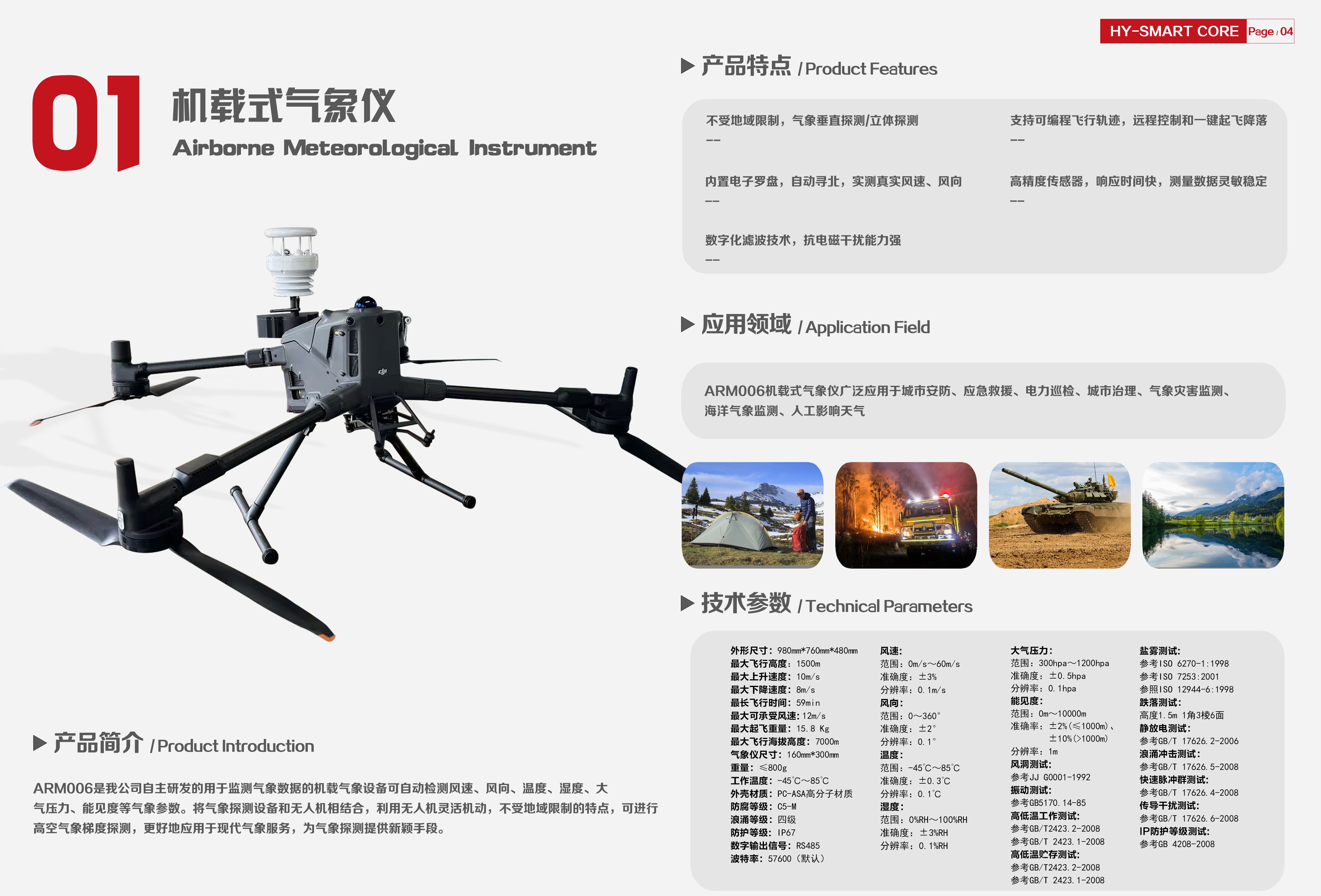
Four axis attitude calibration: Built in electronic compass+IMU inertial unit, automatically compensates for the impact of drone flight attitude on data
Ultrasonic wind measurement system: with a range of 60m/s and an accuracy of ± 0.1m/s, it accurately reproduces the three-dimensional wind field
Anti interference architecture: Digital filtering technology resists strong electromagnetic interference, with a data integrity rate of over 99.8% within 30 meters of the substation
Modular payload design makes equipment a 'airborne transformer'
Compatible with the full range of DJI M300/M350/M400 unmanned aerial vehicle platforms
Support customized payloads to meet special monitoring needs
Urban Planning and Microclimate Optimization
Architectural layout optimization: Obtain surrounding wind speed data through wind field scanning, optimize building spacing, shape, and ventilation corridor design.
Facility safety assessment: Monitor the wind field around facilities such as bridges and power towers, and warn of structural safety hazards caused by strong winds.
Meteorological Disaster Warning and Emergency Response
Typhoon/rainstorm monitoring: enter the cloud belt outside the typhoon to collect vertical wind field data, and improve the accuracy of path and intensity prediction; In waterlogging scenarios, wind speed monitoring is used to assist drainage scheduling and reduce the risk of waterlogging.
Rescue support: Obtain wind speed and direction at the forest fire scene during firefighting, and dynamically adjust firefighting deployment; Simulate the diffusion path of pollutants during chemical leaks to guide evacuation.
Environmental Protection and Ecological Monitoring
Air quality control: Track the diffusion path of pollutants such as PM2.5 and VOCs to support air quality warning.
Ecological management: Long term monitoring of wetland and forest wind fields, studying the impact of wind on species migration and evaporation, and supporting ecological restoration.
Transportation and Energy Management
Wind energy assessment: Vertical wind field scanning to evaluate wind farm site selection, providing parameters such as wind speed and turbulence intensity.
Traffic prevention and control: Monitoring and warning of crosswind effects around highways and airports to reduce traffic accident rates.
Research and data fusion
Climate model validation: Provide high-resolution wind field data to improve the accuracy of urban heat island effect and boundary layer research.
Multi source data fusion: combining satellite and ground station data to construct a three-dimensional wind field model, supportingharshWeather forecasting and disaster prevention decision-making.
Implementation of Cloud Data Factory:
Automatically generate 'Meteorological Data Collection Report'
Multi source data fusion analysis to support decision-making systems
Cross platform collaboration capability:
Seamless integration with the meteorological bureau's big data platform
Support command center and multi terminal synchronization of mobile terminals
Compatible with international mainstream meteorological data standards
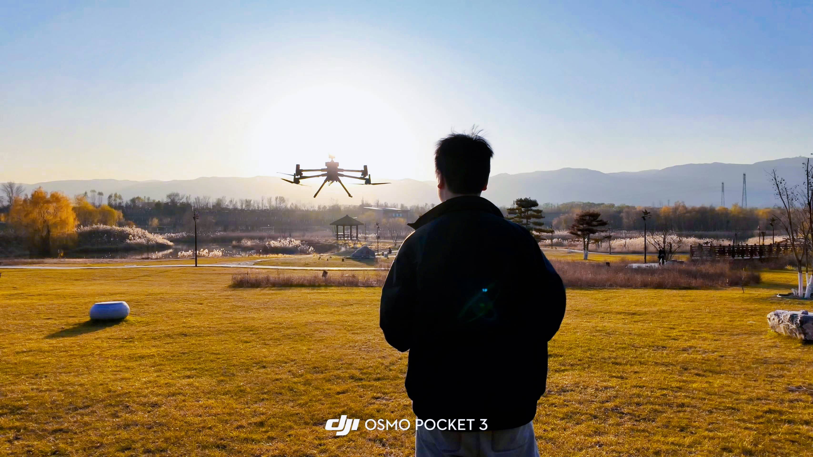
ARM006 is becoming the air data hub for urban management, emergency response, energy security, and other fields with innovative technological concepts and practical performance. From the rooftops of skyscrapers to offshore platforms, from the summit of snow capped mountains to the frontline of emergency response, it redefines the boundaries of environmental perception with high-altitude meteorological data.
Technology empowers airspace perception, data-driven precision decision-making

Top 10 Chinese Polyacrylamide Brands Worth Knowing: An Industry Overview

Why Choose Chinese Polyacrylamide Manufacturers for Cost-Effective Industrial Solutions
Shouxin Advanced Polymer Sciences provides high-performance polyacrylamide (PAM) solutions for water treatment, mining, pulp and paper, and industrial applications.