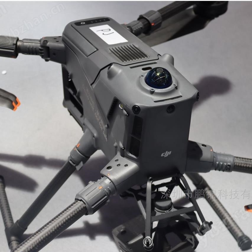
Altum PT multispectral camera Built in DLS-3 optical sensor, Altum PT is a flagship three in one unmanned aerial vehicle remote sensing device launched by MicaSense. It integrates multispectral, panchromatic sharpening and thermal imaging functions, synchronously outputs high-resolution spectral and temperature data, and is a professional level data acquisition solution for precision agriculture, scientific phenotype analysis, ecological monitoring and other fields.
Altum PT multispectral camera Built in DLS-3 optical sensor
High precision radiation calibration systemBuilt in DLS2 optical sensor and CRP2 calibration reflector, achieving automated radiation calibration with a radiation accuracy of ± 3%. The data consistency is significantly improved under different lighting conditions, and traceable reflectance data is directly output.
Multi modal data synchronous acquisitionSeamless integration of 5 narrowband multispectral bands, 12MP panchromatic sensor, and 320 × 256 FLIR Boson ® Thermal imaging module, pixel level synchronous acquisition (error<1ms), no need for post registration, significantly reducing data processing time by 40%.
Ultra high spatial resolutionAt a flight altitude of 60 meters, the ground resolution after full-color sharpening reaches 1.25cm/pixel, which can clearly capture subtle features such as crop leaf veins and young tree counts; Thermal imaging has a GSD of 17cm at the same height, accurately capturing temperature differences.
Anti distortion and wide adaptabilityAdopting a global shutter design to eliminate image distortion caused by high-speed drone flight; Support 0.1-20000lux wide lighting scenarios, suitable for complex terrain operations such as hills and terraces, with data reliability of over 95%.
Spectral and imaging parametersMulti spectral coverage of blue (475nm ± 32nm), green (560nm ± 27nm), red (668nm ± 14nm), red edge (717nm ± 12nm), near-infrared (842nm ± 57nm), panchromatic band 4112 × 3008 pixels, thermal imaging temperature measurement range -10 ℃ to 65 ℃.
Core physical parametersWeight 460g, size 11.0 × 8.0 × 6.9cm, power consumption 5.5-10W (standby peak), input voltage 7.0-25.2V, compatible with mainstream drone power supply systems.
Storage and collection efficiencySupports CFexpress cards (up to 2TB), with 2 frames per second of RAW DNG format continuous shooting, improving efficiency by 100% compared to the previous generation. It can cover 500 acres of farmland in 1 hour and is suitable for large-scale operation scenarios.
Field of view angle and resolutionMulti spectral field of view angle 50 °× 38 °, panchromatic 46 °× 35 °, thermal imaging 48 °× 39 °; At a height of 120 meters, the resolution of multispectral sharpening is 2.49cm, and the thermal imaging is 33.5cm.
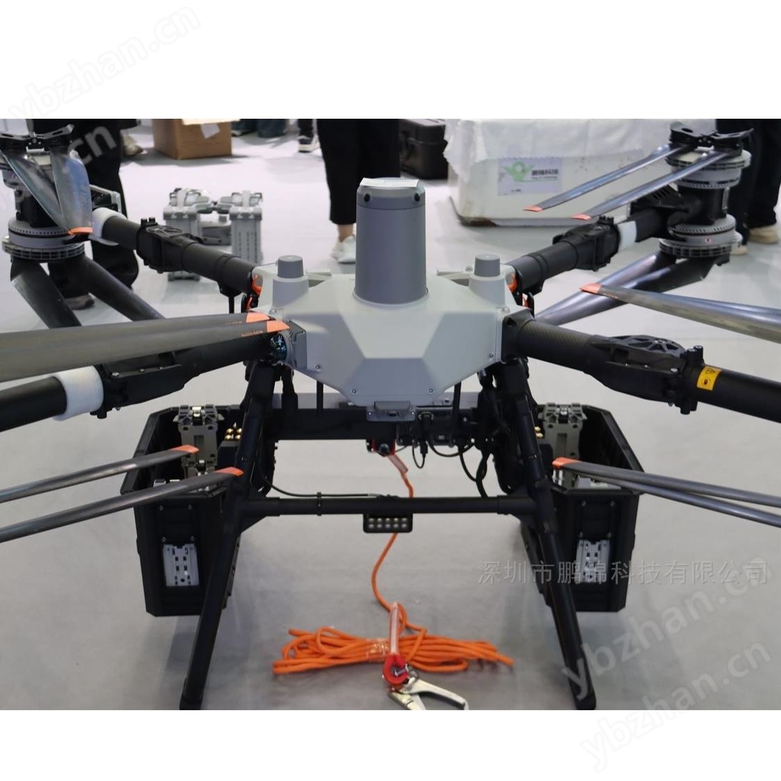
Seamless adaptation across multiple platformsQuickly mount mainstream drones such as Matrice 300/200 series using the DJI Skyport kit, while supporting platforms such as EcoDrone UAS-4/8. Paired with a magnetically encoded self stabilizing gimbal, it is suitable for fixed wing and multi rotor drone scenarios.
Efficient and convenient data processingMulti source data comes with geographic reference information and can be directly imported into software such as Pix4D and Agisoft Metashape for processing, generating vegetation indices and thermal distribution maps such as NDVI and NDRE without the need for additional registration steps.
AI algorithm deep compatibilityHigh resolution spectral data can be directly used as input for deep learning models, supporting intelligent applications such as crop pest identification and yield prediction. The IoU for sugarcane ant and fly pest identification reaches 86%, and the accuracy of corn yield prediction is during the grain filling period.
Highly scalableOpen HTTP/Serial/MavLink API, supporting secondary development and automated workflow integration; Optional remote data transmission module to meet real-time monitoring and large-scale operation requirements.
precision agricultureBy integrating spectroscopy and thermal imaging, problems such as wheat stripe rust and corn nitrogen deficiency can be identified 5-7 days in advance, reducing fertilizer usage by 20% -30%; Combining the random forest algorithm to achieve accurate prediction of maize yield throughout the entire growth period.
Research phenotype analysisA resolution of 1.25cm can capture crop morphological differences at the 0.1mm level, supporting high-throughput plant phenotype analysis, quantifying the effects of stress such as drought and high temperature on crop physiology, and accelerating the process of variety improvement.
Ecological and Environmental MonitoringWith stable radiation calibration capability, accurately quantify vegetation coverage and water pollution status; The thermal imaging module can assist in identifying forest fire points and wetland water distribution, providing data support for ecological protection.
Electricity and Building InspectionThe thermal imaging function can locate potential thermal anomalies in transmission lines, and multispectral data can assist in analyzing the aging status of equipment; In the field of architecture, energy-saving losses can be evaluated to provide a basis for optimizing green buildings.
Altum PT multispectral camera Built in DLS-3 optical sensor