-
E-mail
991516209@qq.com
-
Phone
13276368698
-
Address
Room 308, 3rd Floor, Building 1, Weifang High tech Zone Optoelectronic Industry Accelerator (Phase I), No. 155 Guangdian Road, Yuqing Community, Xincheng Street, Weifang High tech Zone, Shandong Province (for office use only)
Product Categories
Shandong Hengce Environmental Technology Co., Ltd
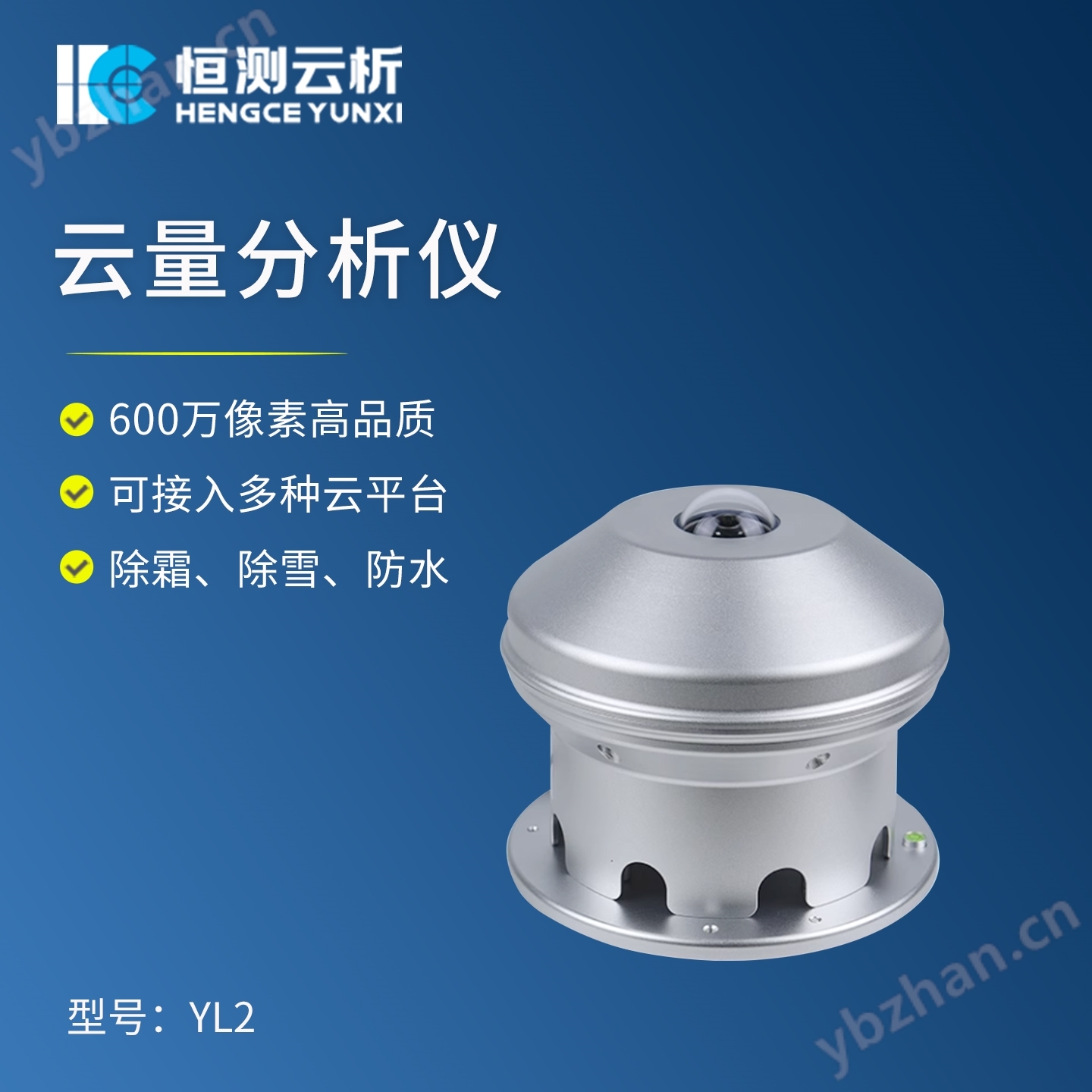

Cloud cover analyzer
NegotiableUpdate on 11/20
- Model
- Nature of the Manufacturer
- Producers
- Product Category
- Place of Origin
Overview
The YL2 cloud cover analyzer adopts a professional grade cloud photography fisheye lens, which automatically records the cloud distribution data of the entire sky in the absence of solar obstruction devices and direct sunlight. This all sky imaging camera is equipped with a 6 megapixel high-quality panoramic cloud shooting photosensitive module, which can capture up to 3000 images; #215; 2008 image.
Product Details
![]()
1、 Product Overview:
YL2 typeCloud cover analyzerUsing a professional grade cloud photography fisheye lens, it automatically records cloud distribution data across the entire sky without any sun blocking devices or direct sunlight. This all sky imaging camera is equipped with a 6 megapixel high-quality panoramic cloud shooting photosensitive module, which can capture up to 3000 × 2008 images.
YL2 typeCloud cover analyzerIt has dynamic analysis function, which can clearly record the sky cloud cover during daylight hours and automatically save it to the local machine for comparison and analysis. It can also be uploaded to the cloud for cloud information recognition through AI algorithms. It can be widely applied in fields such as meteorology, transportation, marine research, and smart cities.

![]()
2、 Product features:
1. 6 million pixel high-quality professional grade panoramic cloud shooting photosensitive module;
2. Optimized AI cloud based information processing and weather phenomenon recognition technology;
3Maximum output capability3000×2008 30fpsImage;
4. Static removal of surrounding buildings, dynamic removal of sunlight and aircraft AI level recognition, effectively recording cloud condition information throughout the sky;
5. Supports multiple transmission methods such as Ethernet, 4G, and WiFi;
6. Can connect to the network, remotely operate and monitor through terminals, and access multiple cloud platforms;
7. Low power consumption, small size, light weight, easy to install in the field;
8. It has defrosting, snow removal, and waterproof functions, and can be used for all-weather observation;
3、 Technical indicators: