DJI M400 unmanned aerial vehicle - Long endurance covering the entire line/defect recognition, with "long endurance, strong load, omnidirectional obstacle avoidance, intelligent operation" as the core advantage, covering multiple industry scenarios such as energy inspection, surveying and modeling, emergency rescue, etc., redefining the efficiency and safety standards of unmanned aerial vehicle operations in the industry.
DJI M400 Drone - Long Range Coverage of All Lines/Defect Recognition
-
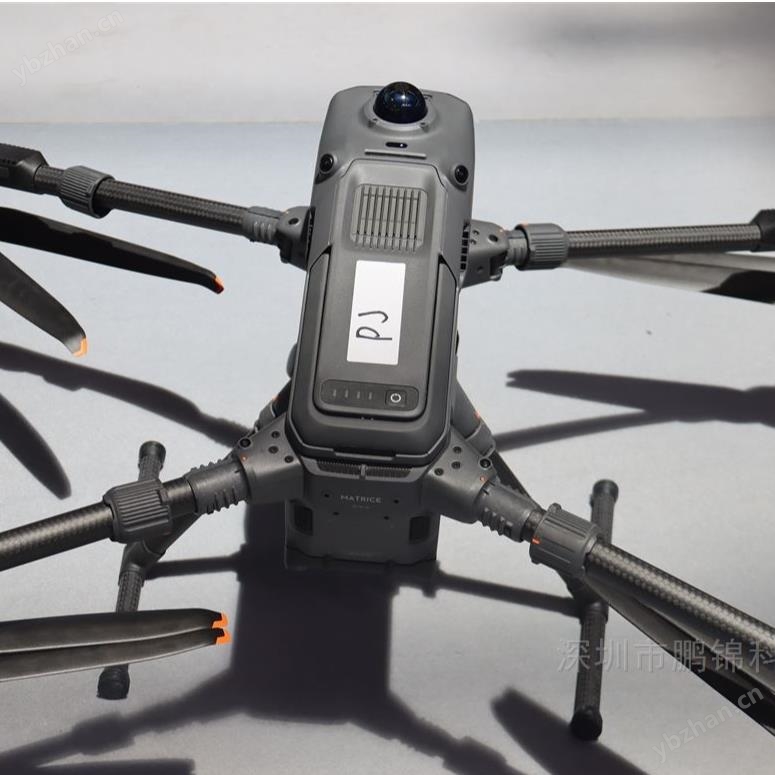
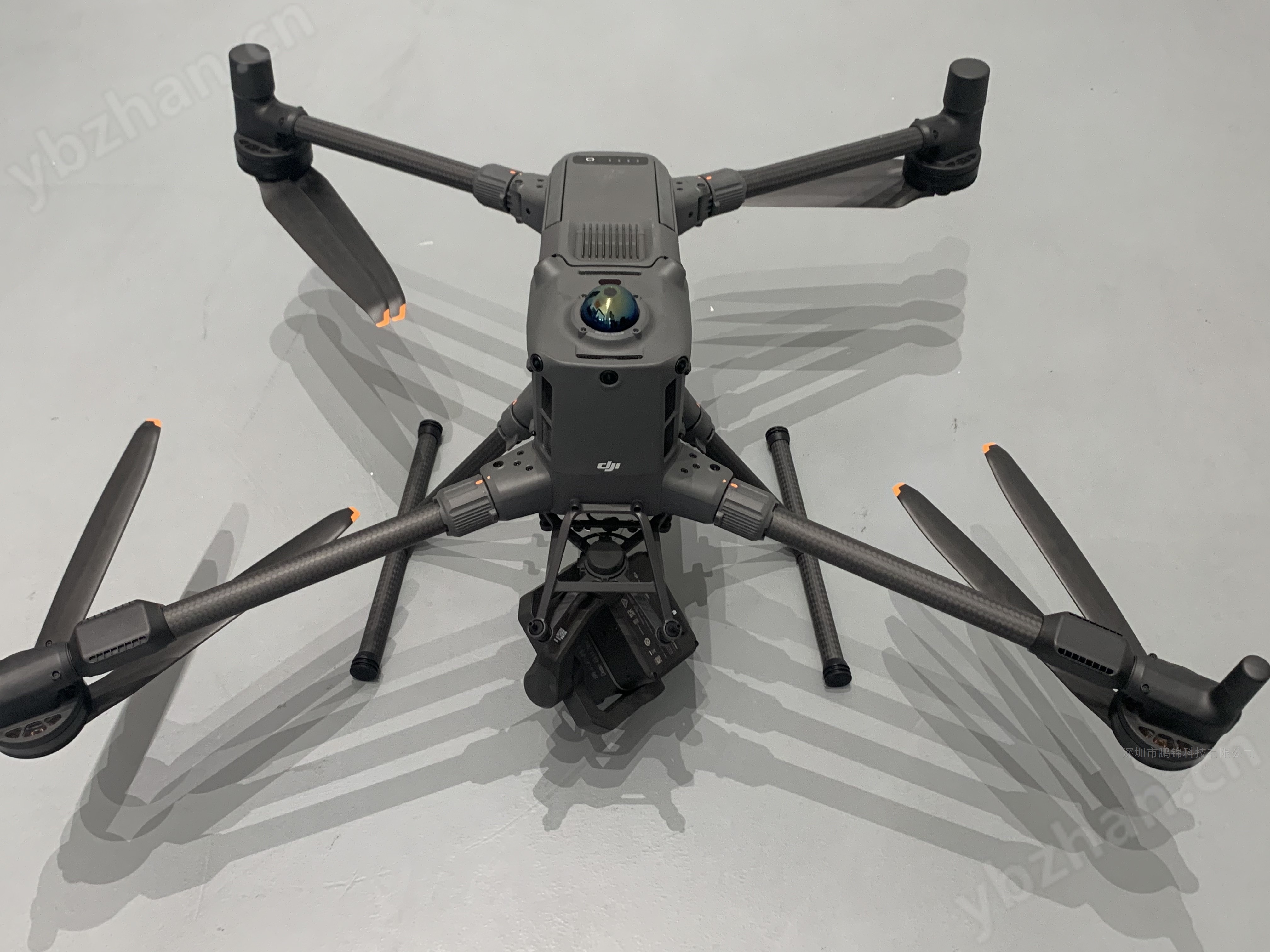
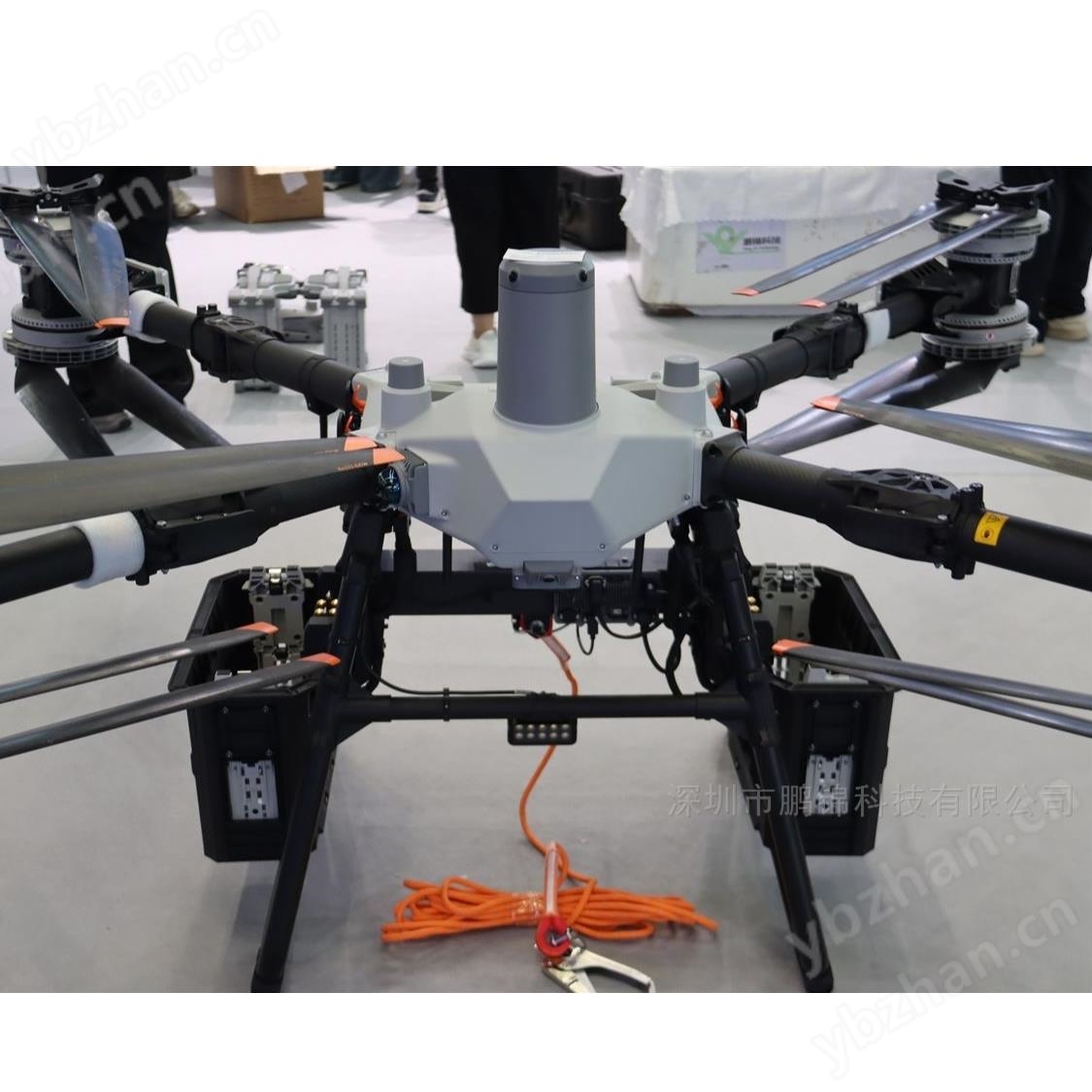
Endurance and Flight Performance
When mounting a single load (such as H30T), the forward flight endurance is 59 minutes and the hover endurance is 53 minutes, which is 50% higher than the previous generation. The maximum flight speed is 25 meters per second, the ascent speed is 10 meters per second, the descent speed is 8 meters per second, and it supports a maximum takeoff altitude of 7000 meters.
-
Load and scalability
The maximum load capacity is 6kg, and up to 7 loads can be mounted at the same time. The body is equipped with 4 E-Port V2 interfaces, supporting single/double pan tilt zoom and a third pan tilt zoom bracket on the belly, compatible with DJI loads and third-party devices.
-
Image transmission and signal guarantee
Equipped with O4 image transmission industry enhanced version, the maximum transmission distance under FCC standard is 40 kilometers, supporting Sub-2G frequency band and relay function, and can install 2 enhanced image transmission modules to switch operator networks, ensuring stable signals in complex environments.
-
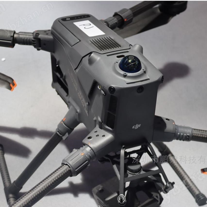
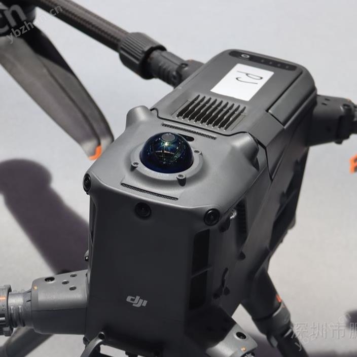
Obstacle avoidance and positioning accuracy
By integrating ring scanning lidar, six directional millimeter wave radar, and four sets of full-color low light fisheye sensors, it can recognize small wires with a diameter of 12 millimeters and accurately avoid obstacles at high speeds of 25 meters per second. RTK positioning accuracy reaches 1cm+1ppm, supporting real-time ground simulation flight.
-
environmental adaptability
Protection level IP55, working temperature range -20 ℃~50 ℃, can operate in mild rain, snow, sand, and low visibility environments, with a detection distance of up to 35 meters through rain and fog at night.
-
Comprehensive upgrade of security protection
The omnidirectional multimodal obstacle avoidance system achieves "wire level obstacle avoidance" and can accurately perceive obstacles in complex environments such as night, rain, and fog. The AR projection function can display obstacles, building names, and flight trajectories in real time, and display near ground projections during landing, reducing operational barriers.
-
A qualitative leap in homework efficiency
The flight speed of 25 meters per second has increased the efficiency of 2D orthographic surveying by 60% compared to M350 RTK, and with the support of Zenith L3 LiDAR, it can cover 10 square kilometers in a single flight, with a daily operational area of 100 square kilometers. Support inclined plane and geometric trajectory planning, and complete complex scene data collection without manual intervention.
-
Multi scene exclusive functions
New dynamic ship takeoff and landing function has been added, which can safely land when the ship speed is below 10 knots and the wind speed is below 5 meters per second, suitable for maritime operations. The power inspection scenario supports automatic winding and crossing of simulated lines, as well as automatic inspection of grounding wires. A single inspection can cover 45 kilometers of transmission lines.
-
Deep empowerment of intelligent ecology
Support thermal imaging model detection, recognize up to 1000 targets per single photo, and can switch to third-party detection models. Equipped with Miaohua 3 (100 TOPS computing power, 120g lightweight design), supporting PSDK development, third-party can quickly build automation solutions.
-
Energy inspection
Equipped with Zenith H30T thermal imaging load, it can identify equipment overheating hazards with a temperature difference of 0.1 ℃, and the accuracy of insulator defect detection at night reaches 98%. The simulated flight does not require detours or crossings, and the operational efficiency of Nanning Power Supply Bureau has been improved by more than twice after its application.
-
Surveying and Mapping Modeling
Support 1:500 scale surveying, with a ground sampling distance (GSD) of up to 3 centimeters at an altitude of 300 meters. Paired with Zenith L2/L3 LiDAR, it takes only 10 minutes to complete 0.3 square kilometers of surveying and mapping in Yunnan open-pit mines, with a measurement error of less than 3% for earthwork volume.
-
emergency rescue
59 minute long battery life supports long-distance material delivery, and RTK precise positioning can accurately deliver first aid kits in disaster areas. Real time simulated ground flight ensures that the target size is consistent in the search and rescue scene, and the point, line, and surface drawing results are synchronized with the Sikong 2 cloud platform, facilitating team collaboration.
-
Maritime and Infrastructure
The dynamic ship takeoff and landing function is suitable for offshore wind turbine inspection and maritime inspection, and can safely take off and land on moving ships. In engineering monitoring scenarios, precise inspections can be carried out on bridges, tunnels, and slopes, significantly improving the detection rate of structural defects.
-
Forestry and Environmental Protection
Large scale patrols can quickly identify forestry pests and diseases, and with corresponding loads, can accurately capture the traces of pollution sources, helping to protect the ecological environment of river and lake shorelines and control illegal pollution discharge.
summaryThe DJI M400, with "safety, efficiency, intelligence, and compatibility" as its core, has become a flagship solution in the fields of energy, surveying, emergency response, maritime affairs, etc. through comprehensive upgrades in endurance, obstacle avoidance, and load capacity, combined with industry-specific functions and open ecology. It not only significantly improves the efficiency of single device operations, but also promotes the deep expansion of "low altitude+" industry applications through collaborative software and development support, making it an industry level drone.
DJI M400 Drone - Long Range Coverage of All Lines/Defect Recognition