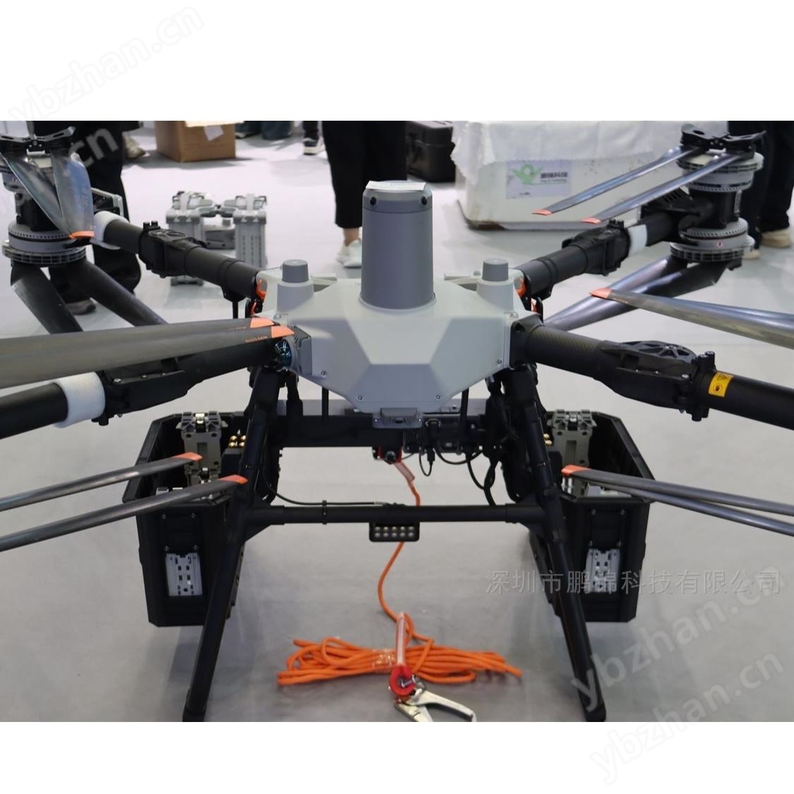
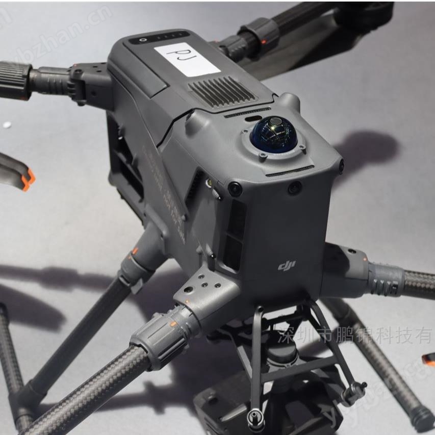
DJI Zenith L3 LiDAR -16 Echo Point Cloud Acquisition Equipment. DJI Zenith L3 is a long range high-precision aerial survey LiDAR system independently developed by DJI, with 1535nm laser and dual 100 million pixel cameras as the core. It combines a 950 meter long survey range, 3 centimeter level elevation accuracy, and 100 square kilometers/day operation efficiency. It is a 3D data acquisition solution for professional surveying, power inspection, forestry investigation and other fields.
DJI Zenith L3 Lidar-16 Echo Point Cloud Acquisition Equipment
Long range strong penetration laser systemThe 1535nm laser wavelength is more eye friendly, with a measurement range of 950 meters at 10% reflectivity and an extension to 2000 meters at 80% reflectivity. The divergence angle of the 0.25mrad laser is only 1/5 of the previous generation, and the spot is more concentrated, which can accurately identify small targets such as wires and tree branches, greatly improving the acquisition of ground points under the forest.
Dual modal high-precision synchronous acquisitionFusion of dual 100 megapixel 4/3 CMOS cameras, with a 107 ° wide field of view covering a wider area. Lidar and camera are synchronized in microsecond time, and can output multiple types of results such as point clouds, DOM, DEM, etc. synchronously in one flight. A 20% lateral overlap rate can meet high-precision requirements.
Ultra high precision pose and point cloudThe self-developed pose system achieves post-processing accuracy of 0.02 ° heading and 0.01 ° pitch/roll, with a repeat ranging accuracy of less than 5 millimeters at 150 meters. The accuracy of 120 meter elevation is 3 centimeters, and the accuracy of 300 meter elevation is 5 centimeters, suitable for surveying at a scale of 1:500 to 1:2000.
Multi mode efficient homeworkThe point frequency can be flexibly adjusted from 100kHz to 2000kHz, supporting up to 16 echo acquisition, and adding a zigzag repeated scanning mode to adapt to forest scenes. Paired with M400 drones, the daily operating area reaches 100 square kilometers, which is 3-5 times more efficient than traditional equipment.
Whole process ecological collaborationFrom DJI Pilot 2 route planning, to DJI Smart Map point cloud processing (supporting multiple formats such as LAS/PLY export), and then to Sikong 2 cloud management, a one-stop solution has been formed, resulting in a 50% increase in office processing efficiency.
Special optimization of power inspectionSupports up to 130 meters of simulated line flight, without the need to detour or cross obstacles. It can clearly identify 21.6mm steel core aluminum stranded wire at a distance of 300 meters, with a tree obstacle recognition accuracy of over 98%.
Data Security and ReliabilitySupports storage card encryption and AES-256 image transmission encryption to prevent data leakage. The IP54 protection level can cope with rain, snow, sand and dust environments, meeting the needs of all-weather operations.
Low threshold and easy to operateThree axis gimbal with no self check and quick start, the roll axis increases stability to counteract body shaking. Pilot 2 displays point clouds and images in split screens, making it easy for beginners to quickly get started and significantly reducing the threshold for professional aerial surveying.
Professional Surveying and Engineering Surveying1:500 scale topographic map drawing does not require ground control points, and the monitoring accuracy of mine slopes is ± 5cm. It can quickly generate three-dimensional terrain models to support engineering design and construction supervision.
Power channel inspectionEfficient collection of wire and tower data through simulated flight, automatic identification of tree obstacle intrusion, wire hot spots, and hardware damage. A single person can complete a 300 kilometer line inspection in a single day, increasing efficiency by 20 times.
Forestry Investigation and Carbon Sequestration MonitoringStrong penetrability can obtain understory ground points, with a single tree recognition rate of 95%, a breast height diameter measurement error of less than 3cm, and an improved carbon storage estimation accuracy of ± 8%, which helps with carbon sequestration project certification.
Emergency Surveying and Urban ModelingQuickly reconstruct 3D scenes at disaster sites to provide data support for rescue decision-making; The point cloud density for modeling urban architectural complexes reaches 50 points per square centimeter, accurately reproducing architectural details.
Mounting and CalibrationMount the M400 E1 interface through the DJI SKYPORT quick release interface, and complete IMU calibration and LiDAR internal parameter calibration before flight to ensure data accuracy.
Homework settingsSelect the scanning mode according to the scene, repeat scanning in a straight line for plain surveying, and scan in a meter line for forest investigation. It is recommended to control the speed at 15-17 m/s.
Storage and Data ProcessingUse UHS-II high-speed CFexpress cards with a capacity of ≥ 64GB to avoid data storage lag; DJI Smart Map supports cluster computing to accelerate large-scale point cloud processing.
routine maintenanceRegularly clean the laser window and camera lens to avoid dust affecting imaging; Long term storage requires a dry environment and a comprehensive inspection should be conducted every 50 flight hours.
DJI Zenith L3 Lidar-16 Echo Point Cloud Acquisition Equipment