HY-9010-L hyperspectral camera for agricultural remote sensing and vegetation ecological monitoring is a lightweight unmanned aerial vehicle (UAV) hyperspectral imaging system developed based on the flagship product platform of DJI industrial grade UAVs. It was developed by Hangzhou Hyperspectral Imaging Technology Co., Ltd.
HY-9010-L hyperspectral camera for agricultural remote sensing vegetation ecological monitoring
-
Full spectrum fine detection capability
Covering the visible to near-infrared wavelength range of 400-1000nm, with a spectral resolution better than 2.5nm, it can accurately capture the characteristic absorption peaks of different substances. For example, spectral differences in trace components such as total phosphorus and ammonia nitrogen can be distinguished in water quality monitoring, and subtle spectral changes in rice nitrogen deficiency and leaf blast disease can be identified in the agricultural field. Equipped with a 1920 × 1200 pixel large target CMOS sensor, it supports parallel acquisition of 1920 spatial channels and 1200 spectral channels. With one flight, it can obtain 300 spectral bands of hyperspectral data and 15 million pixel high-definition visible light images, achieving multi-dimensional data fusion of "spectrum integration".
-
Efficient scanning, imaging, and positioning synchronization
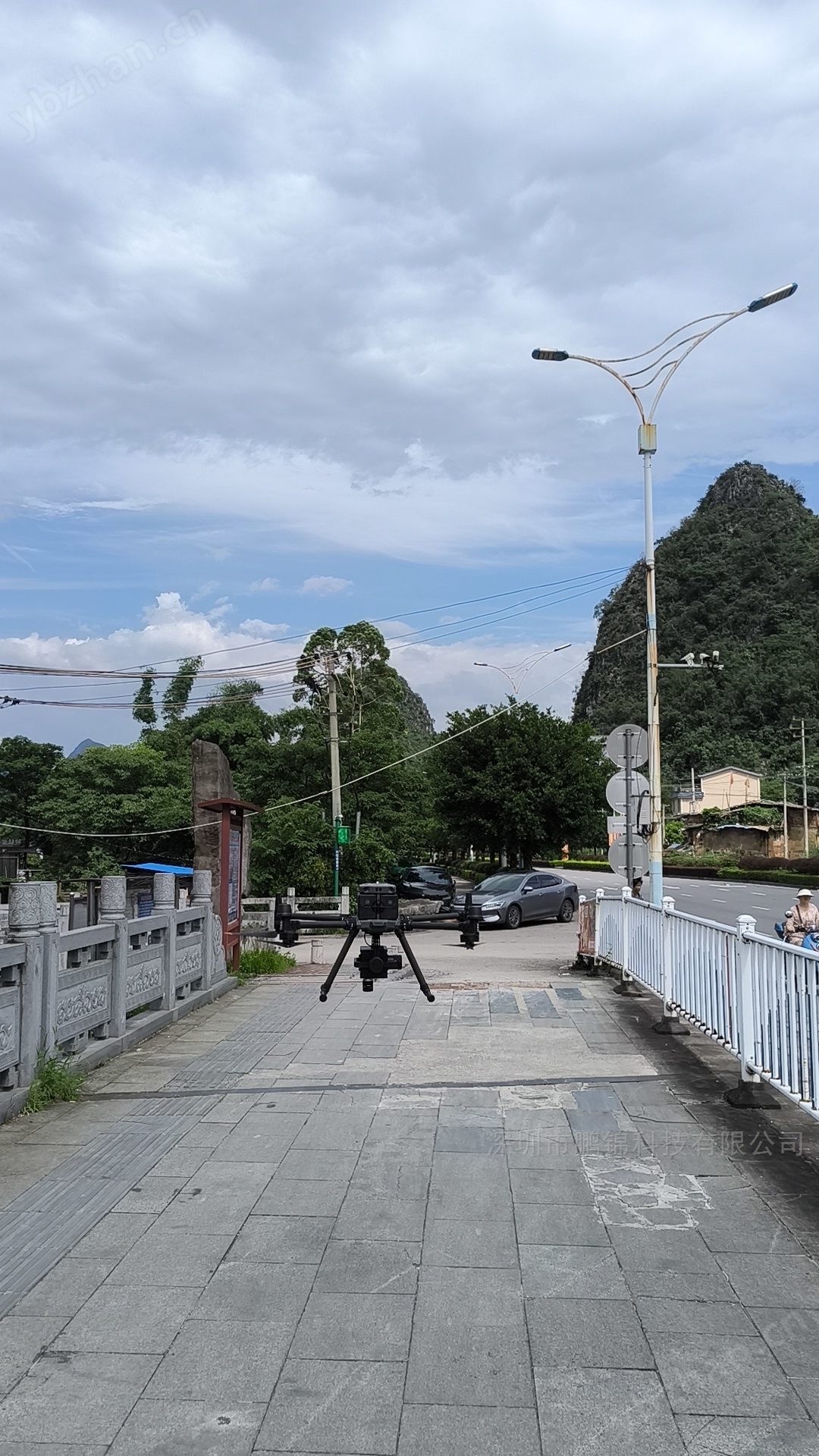
Adopting a drone push scan imaging mode, large-scale scanning can be completed without hovering. With a high frame rate performance of 128fps, a single flight of the DJI M300 RTK drone can cover 2 square kilometers of water at a flight altitude of 50 meters, and the operational efficiency is more than three times higher than traditional hovering equipment. Integrated DJI RTK function, supporting line by line correspondence between GPS data and hyperspectral data, combined with optional PPK calculation module, the positioning accuracy can reach centimeter level, ensuring accurate matching of geographic coordinates for each spectral sampling point and providing spatial positioning basis for pollution tracing.
-
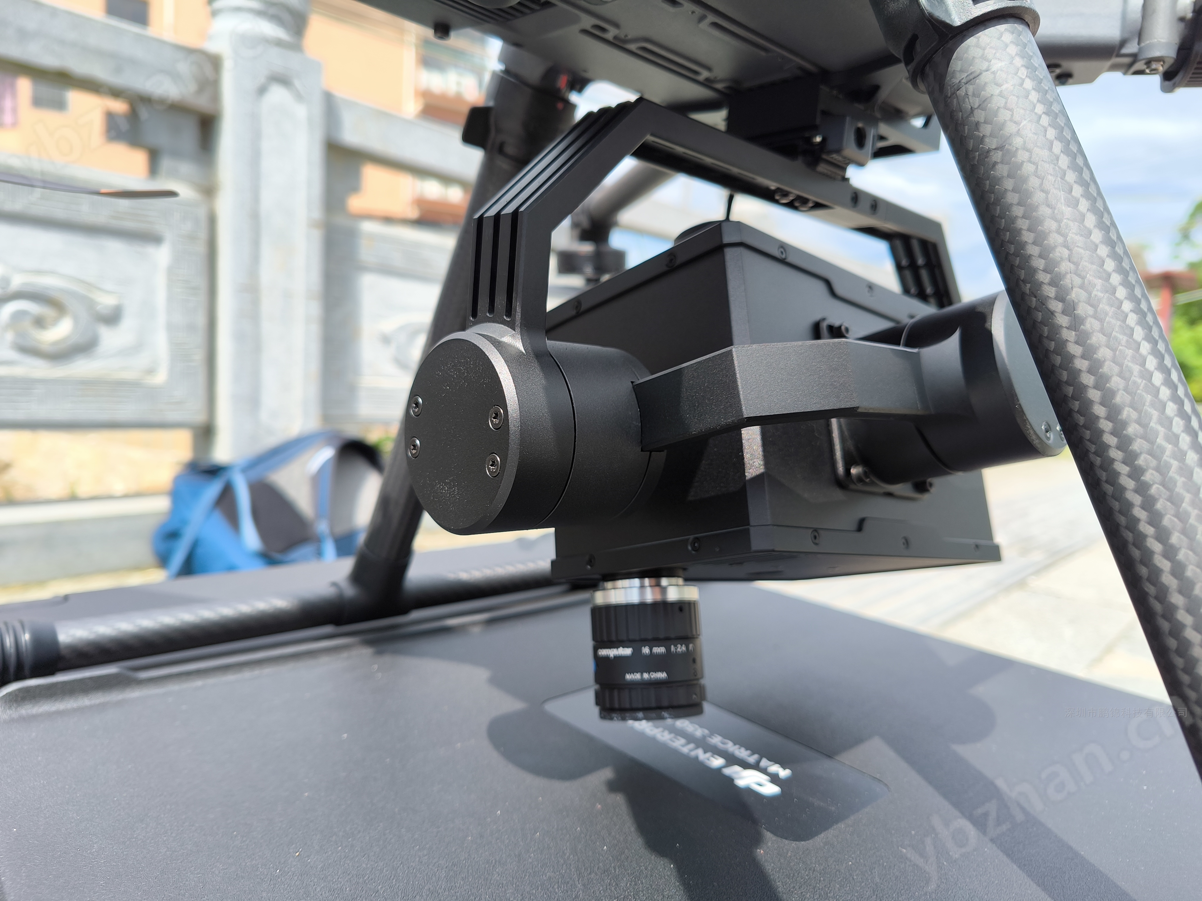
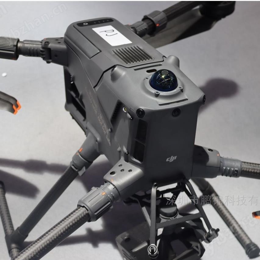
Hardware integration and environmental adaptability
Deeply adapted to mainstream unmanned aerial vehicle platforms such as DJI M300 RTK and M600 Pro, only one data cable is needed to achieve power supply and data communication, with a compact structure and strong compatibility. Built in three-axis gimbal self stabilization system, which can counteract drone flight shaking and ensure imaging clarity; The operating temperature range of the equipment is from 10 ℃ to 50 ℃, with built-in 1TB SSD storage to meet the needs of long-term outdoor operations. Supporting remote intelligent control and real-time image transmission, the ground station can synchronously display multi band synthesized images and spatial point spectral curves, making it easy to quickly identify abnormal areas during operations.
Environmental monitoring and pollution control
water quality analysisSix core water quality parameters, including total nitrogen, total phosphorus, chlorophyll-a, and suspended solids, can be synchronously inverted to generate a thermal map of pollutant concentration. The inversion results match the measured data with an accuracy of over 80%, making it suitable for monitoring river channels, lakes, and industrial wastewater. For example, in the monitoring of a river channel in Shanghai, the concentration distribution of indicators such as CODMn, TP, and NH3-N was analyzed to effectively locate the diffusion path of pollution sources.
Soil assessmentBy analyzing soil moisture content, fertility, and heavy metal pollution through spectroscopy, a soil nutrient distribution map is generated to guide precise fertilization and pollution remediation.
Smart Agriculture and Forestry Survey
Crop Health ManagementUsing vegetation indices such as NDVI to monitor crop growth and identify early characteristics of pests and diseases. In rice disease monitoring, the accuracy of disease grade prediction based on PNN neural network model reaches 85%, which can provide early warning of common diseases such as bacterial leaf blight.
Precise planting decisionDetecting fruit maturity, sugar content, and pesticide residues to optimize harvesting timing; Draw a soil fertility distribution map to achieve variable fertilization and water-saving irrigation.
Geological Exploration and National Defense Applications
Mineral resource explorationAssist in mineralization prediction and resource assessment through mineral spectral feature identification and mapping.
The ability to use hyperspectral imaging to penetrate materials and identify hidden targets has been showcased as a solution at the National Defense Technology Exhibition.
HY-9010-L hyperspectral camera for agricultural remote sensing vegetation ecological monitoring