-
E-mail
wujinmei@four-faith.com
-
Phone
13959264836
-
Address
5th Floor, Building B14, Software Park Phase III, Jimei District, Xiamen
Product Categories
- Field water-saving irrigation controller
- Radar flowmeter
- Smart Irrigation Area Information Management Platform
- Video telemetry terminal RTU
- Comprehensive Reform Platform for Agricultural Water Prices
- Wireless warning broadcast
- Pull rope displacement sensor
- The Ministry of Water Resources recommends wireless warning broadcasting for evaluation
- GNSS receiver
- Well controller
- Radar flowmeter
- Water conservancy informatization platform
- Tipping bucket rain sensor
- Universal monitoring equipment
- Integrated monitoring station
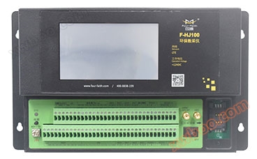
- Environmental protection data acquisition instrument
- Intelligent valve controller
- Integrated water level gauge
- MCU multifunctional telemetry terminal
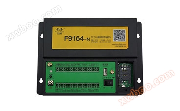
- RTU telemetry terminal
- Beidou series terminal
Xiamen Sixin IoT Technology Co., Ltd

Large scale intelligent irrigation area information management system cloud platform software
NegotiableUpdate on 04/14
- Model
- Nature of the Manufacturer
- Producers
- Product Category
- Place of Origin
Overview
● Practical functions, user-friendly interface ● Easy to manage, easy to maintain, simple to operate, easy to learn and use ● Remote management ● Fault diagnosis ● Interface meets the principles of openness and standardization ● Irrigation area management with one map
Product Details
The cloud platform software for large-scale intelligent irrigation area information management system is a specially designed intelligent management software platform for irrigation area information management. The platform aims to optimize the allocation and scheduling of irrigation area water resources, with data as the core, to achieve a "one map" of irrigation area management.
The intelligent irrigation area informatization comprehensive management platform is developed and designed according to the principles of standardization and normalization, scientificity and progressiveness, openness and expansibility, economy and practicality, and in combination with the current advanced artificial intelligence, Internet of Things technology, cloud service technology, spatial geographic information technology and mobile application technology. The platform covers information collection, water management, water fee collection, flood control and drought resistance, engineering inspection and other application functions related to intelligent management of irrigation areas. It presents rich graphics and data interfaces, simplified operation function modules, and is close to the actual management of irrigation areas, providing efficient management and data support services for the intelligence and informatization of the irrigation industry.
The overall architecture of the intelligent irrigation area information comprehensive management platform is divided into a collection layer, a data layer, a support layer, an application layer, and a user layer. At the same time, the security guarantee system provides security guarantees for the entire level of the system. The irrigation area information system includes links such as collection, transmission, processing, storage, application, and decision support, as well as the establishment of some infrastructure, such as collection equipment and management center environment. The irrigation area information management platform combines the characteristics of irrigation area management and the principles of informationization and security guarantee of the Internet of Things system platform to achieve a hierarchical design of the overall platform architecture and a flat application architecture. This not only ensures system security, but also enables irrigation area management to achieve closed-loop operation of application modules, data information reuse and sharing, and improves the efficiency and operability of irrigation area management.

The application architecture of the intelligent irrigation area information comprehensive management platform includes: irrigation area overview, irrigation area management map, information collection and monitoring system, gate remote monitoring system, water measurement management system, water distribution and scheduling management system, comprehensive information management system, equipment management system, water cost management system, engineering management system, operation and maintenance support management system, flood control and drought resistance monitoring and early warning system, mobile intelligent terminal system, etc.


The front-end monitoring data of the irrigation area includes water condition monitoring, rainfall monitoring, flow monitoring, meteorological monitoring, soil moisture, gate control, video, image, etc. The front-end monitoring data of the irrigation area is automatically sent to the irrigation area information center in real-time or at regular intervals through the telemetry network. The information collection and processing system receives the monitoring data sent by the telemetry end, verifies the legitimacy of the data, and stores the correct data in the database. The water monitoring and photography system also uses telemetry networks to store the collected monitoring data in a database, and the image data is stored in local files.
Based on the information collection and processing system, the collected data is provided for use in the measurement water management system, water distribution scheduling management system, water fee collection management system, and flood control and drought resistance management system. The measurement water management system calculates the water level flow relationship and compiles water conditions based on the provided data. The water distribution and scheduling management system conducts water distribution and scheduling based on the provided data. It achieves water distribution and scheduling through user water demand reporting, water distribution planning, execution of water distribution instructions, and water quantity statistics. The water fee collection management system settles, collects, and statistically analyzes agricultural water fees, industrial water fees, and other water fees based on the provided data. The flood control management system records daily water conditions and water level rainfall based on the provided data, providing flood control data support for water level forecasting and reservoir scheduling. The GIS system for construction and inspection management provides basic data such as engineering data and layout plans for building construction and inspection to the flood control management system.
By utilizing advanced scientific and technological methods, the official WeChat platform is utilized to enable water users to query their own water fees and payments. The mobile intelligent terminal obtains data from four systems, namely the measurement water management system, water distribution scheduling management system, water fee collection management system, and water situation monitoring and photography system, to achieve data operations such as water rain monitoring, water distribution instructions, water usage timing certificates, and image acquisition. It provides convenient and fast information services for irrigation staff and water users.

☛ Integrated Station - Gate Monitoring Station


 ☛ Integrated Station - Agricultural Meteorological Station


★Irrigation District Management "One Map"


The intelligent irrigation area informatization comprehensive management platform is developed and designed according to the principles of standardization and normalization, scientificity and progressiveness, openness and expansibility, economy and practicality, and in combination with the current advanced artificial intelligence, Internet of Things technology, cloud service technology, spatial geographic information technology and mobile application technology. The platform covers information collection, water management, water fee collection, flood control and drought resistance, engineering inspection and other application functions related to intelligent management of irrigation areas. It presents rich graphics and data interfaces, simplified operation function modules, and is close to the actual management of irrigation areas, providing efficient management and data support services for the intelligence and informatization of the irrigation industry.
The overall architecture of the intelligent irrigation area information comprehensive management platform is divided into a collection layer, a data layer, a support layer, an application layer, and a user layer. At the same time, the security guarantee system provides security guarantees for the entire level of the system. The irrigation area information system includes links such as collection, transmission, processing, storage, application, and decision support, as well as the establishment of some infrastructure, such as collection equipment and management center environment. The irrigation area information management platform combines the characteristics of irrigation area management and the principles of informationization and security guarantee of the Internet of Things system platform to achieve a hierarchical design of the overall platform architecture and a flat application architecture. This not only ensures system security, but also enables irrigation area management to achieve closed-loop operation of application modules, data information reuse and sharing, and improves the efficiency and operability of irrigation area management.
The application architecture of the intelligent irrigation area information comprehensive management platform includes: irrigation area overview, irrigation area management map, information collection and monitoring system, gate remote monitoring system, water measurement management system, water distribution and scheduling management system, comprehensive information management system, equipment management system, water cost management system, engineering management system, operation and maintenance support management system, flood control and drought resistance monitoring and early warning system, mobile intelligent terminal system, etc.
The front-end monitoring data of the irrigation area includes water condition monitoring, rainfall monitoring, flow monitoring, meteorological monitoring, soil moisture, gate control, video, image, etc. The front-end monitoring data of the irrigation area is automatically sent to the irrigation area information center in real-time or at regular intervals through the telemetry network. The information collection and processing system receives the monitoring data sent by the telemetry end, verifies the legitimacy of the data, and stores the correct data in the database. The water monitoring and photography system also uses telemetry networks to store the collected monitoring data in a database, and the image data is stored in local files.
By utilizing advanced scientific and technological methods, the official WeChat platform is utilized to enable water users to query their own water fees and payments. The mobile intelligent terminal obtains data from four systems, namely the measurement water management system, water distribution scheduling management system, water fee collection management system, and water situation monitoring and photography system, to achieve data operations such as water rain monitoring, water distribution instructions, water usage timing certificates, and image acquisition. It provides convenient and fast information services for irrigation staff and water users.
☛ Integrated Station - Gate Monitoring Station
The irrigation gate monitoring station remotely controls and manages the changes in the inlet gate, control gate, or key branch channel and water source head gate of the channel. According to the instructions issued by the system, remotely transmit the target flow rate or water level to the gate controller, adjust the opening of the gate, and make the flow rate or water level of the channel reach the target value. Shortening the opening and closing operation time of the gate can timely grasp the operation information of the irrigation area, provide a basis for optimizing the allocation of water resources, reduce the waste of water resources, and promote the improvement of the comprehensive benefits of the irrigation area.
☛ Integrated Station - Water Measurement Monitoring Station
The irrigation area measurement water monitoring station realizes automatic real-time monitoring of water level and flow rate throughout the entire process of water diversion, transmission, distribution, distribution points, and boundary points, providing data support for the overall scheduling and sub centers of the irrigation area, and achieving optimized allocation of water resources.
☛ Integrated Station - Water and Rain Monitoring Station
The water and rain monitoring station mainly realizes remote automatic collection, photography and monitoring of the entire process of water and rain conditions, and records the dynamic changes in water levels of rivers, reservoirs and channels in real time. The system implements sound, color, and SMS flood prevention and drainage warning functions based on monitoring water level, warning water level, flood control water level, period rainfall, and daily cumulative rainfall. Realize the collection of real-time photos of water and rain conditions on engineering sites such as rivers, channels, reservoirs, and gates, in order to timely and conveniently understand the safe operation of the project. By analyzing the monitored water and rainfall data, it provides auxiliary decision-making basis for the irrigation management department to evaluate the water demand and inflow of the irrigation area, and achieves scientific allocation of water volume.
☛ Integrated Station - Video Surveillance Station
The video surveillance station can accurately, clearly, and quickly transmit real-time images and data from the monitored site to the management center. Through the video surveillance system, the management center can directly understand and grasp the actual situation of each monitored site in real time. At the same time, the on duty personnel at the center make corresponding responses and treatments based on the situation that occurs at the monitored site, thus effectively managing the operation of water conservancy facilities and the surrounding site conditions.
☛ Integrated Station - Soil Moisture Monitoring Station
The soil harvesting monitoring station is the fundamental work for studying water cycle laws, agricultural and animal husbandry irrigation, rational utilization of water resources, and collecting basic information on drought resistance and disaster relief. The soil harvesting information mainly monitors soil moisture content and soil temperature, providing decision-making basis for the irrigation area information system.
The agricultural meteorological station mainly monitors meteorological elements such as temperature, air pressure, relative humidity, wind direction, wind speed, rainfall, light, soil temperature and humidity in the irrigation area, achieving all-weather monitoring of the microclimate of farmland in the irrigation area. Provide system data support for the irrigation area information platform.
★Irrigation District Management "One Map"
The "One Map" of irrigation area management is based on the GIS map of the irrigation area, which aggregates basic topographic maps, administrative area maps, land use status maps, basic farmland protection maps, water system distribution maps, flood control project distribution maps, irrigation project distribution maps, irrigation area distribution maps, water and rain monitoring distribution maps, water resource red line maps, remote sensing image maps and other multi-source information maps. It is overlaid with the business management system of irrigation area water resources and engineering management to build a unified "One Map" of comprehensive supervision of irrigation area with "underground surveying, online control, and platform management".
★Information collection and monitoring system
The information collection and monitoring system includes meteorological station information, water level monitoring information, rainfall monitoring, gate status monitoring, video monitoring, and image monitoring in the irrigation area, etc., to display the monitoring information of the irrigation area and facilitate the management of irrigation area managers.

★Gate remote monitoring system
Remote monitoring of gates enables monitoring and management of manual, automatic duty, and remote start of gates, combined with gate status and image and video display, to achieve remote control and management of gates.


 ★Integrated information management


★Measurement Water Management System
The measurement water management system relies on collected water situation data to perform calculations such as water level flow relationship calculation, canal water utilization coefficient calculation, and water situation compilation. Through curve fitting methods, it derives a highly applicable water level flow relationship curve, providing scientific basis for resource scheduling, water resource management, engineering construction, and comprehensive utilization in irrigation areas, and providing data foundation for information management work in irrigation areas.
★Water distribution scheduling management system
The water distribution scheduling management system can intelligently assist management personnel in formulating water use and distribution plans for each water use unit in the irrigation area based on the water demand of the irrigation unit and the water supply capacity of the irrigation project. Through the system, water distribution instructions are issued to the directly affiliated and grassroots stations in the irrigation area. Based on the data reported by various water measurement points on the telemetry terminal, the water distribution plan and execution situation are analyzed and assessed, thereby effectively improving the efficiency of water use and distribution management in the irrigation area and the accuracy of statistical analysis data.
Conduct historical report management and statistical analysis on the measured water information, alarm information, and water and rain situation information of the entire irrigation area.
★equipment management system
The equipment management system realizes the management of adding and deleting equipment, remote configuration, and remote upgrade services for various monitoring points in the irrigation area, achieving remote management of site equipment, reducing the workload of operation and maintenance administrators, and lowering operation and maintenance service costs.
★Water fee management system


The water fee management system includes water fee collection and water rights trading, providing dynamic configuration functions for water quantity and water fee calculation methods for irrigation area users, enabling irrigation area staff to quickly and accurately settle water fees, smoothly complete water fee collection work, and provide a good tool.
★Engineering Management System
Engineering management is based on the vector diagram of irrigation area water conservancy projects. It presents the distribution and attribute information of various water conservancy projects in the irrigation area, as well as the inspection trajectory and related records, using QR code information presentation and inspection APP tools to achieve informationization of engineering management, maximize engineering benefits, and protect water resources.
★Operation and Maintenance Support Management System
The operation and maintenance support management system includes two major parts: engineering maintenance management and site maintenance management. It records, reviews, assigns, maintains, costs, confirms, etc. abnormal situations reported during engineering inspections, platform warnings, and manual inspections, achieving information-based management and duty arrangements for building and site maintenance in irrigation areas.


★Flood Control and Drought Relief Monitoring and Early Warning System
The flood control and drought resistance management system for irrigation areas is based on real-time monitoring data of irrigation area water and rainfall conditions, combined with the engineering situation of irrigation area reservoirs and hydrological measurement data over the years. It uses mathematical algorithm models to forecast the water inflow situation of irrigation area reservoirs in the medium and short term, and calculates the discharge flow and water transmission flow based on the calculation formula of irrigation area and reservoir inflow, combined with the reservoir water storage situation and downstream water situation monitoring, to ensure the normal operation of irrigation area reservoirs and the normal scheduling of downstream irrigation areas.
★Mobile intelligent terminal system
Mobile intelligent terminals obtain data from measurement water management systems, water distribution scheduling management systems, water fee collection management systems, water situation monitoring and photography systems, etc., to achieve data operations such as water and rain monitoring, water distribution instructions, water usage timing certificates, image acquisition, etc., providing convenient and fast information services for irrigation area workers and water users.
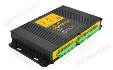
| Remote telemetry terminal RTU |  |
 |
Micro power telemetry terminal |
| Radar water level gauge |  |
Technical Specifications
Related Downloads
Similar Product Recommend