-
E-mail
wujinmei@four-faith.com
-
Phone
13959264836
-
Address
5th Floor, Building B14, Software Park Phase III, Jimei District, Xiamen
Product Categories
- Field water-saving irrigation controller
- Radar flowmeter
- Smart Irrigation Area Information Management Platform
- Video telemetry terminal RTU
- Comprehensive Reform Platform for Agricultural Water Prices
- Wireless warning broadcast
- Pull rope displacement sensor
- The Ministry of Water Resources recommends wireless warning broadcasting for evaluation
- GNSS receiver
- Well controller
- Radar flowmeter
- Water conservancy informatization platform
- Tipping bucket rain sensor
- Universal monitoring equipment
- Integrated monitoring station
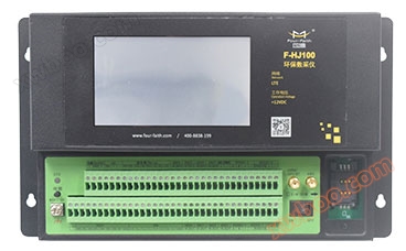
- Environmental protection data acquisition instrument
- Intelligent valve controller
- Integrated water level gauge
- MCU multifunctional telemetry terminal
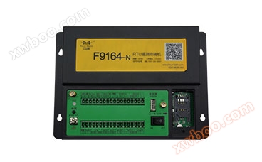
- RTU telemetry terminal
- Beidou series terminal
Xiamen Sixin IoT Technology Co., Ltd

Video and Image Integrated Station
NegotiableUpdate on 04/14
- Model
- Nature of the Manufacturer
- Producers
- Product Category
- Place of Origin
Overview
● Trigger the collection of rainfall ● Regularly collect water level, water quantity, water quality, and other data ● Regularly report rainfall, water level, water quantity, water quality, and other data ● Warning triggers the addition of rainfall, water level, water quantity, water quality, and other data ● Local storage of rainfall, water level, water quantity, water quality, and other data ● Remote query of current rainfall, water level, water quantity, water quality, and other data ● Support image capture function ● Support subtitle overlay function to understand real-time water level, rainfall, and other information of video monitoring points ● Support preset point settings and cruise recording, photography functions ● Provide graded data sharing services ● Powerful database support and storage capacity
Product Details
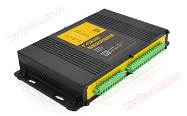
The integrated video and image station collects, processes, and transmits information such as water and rain conditions, video images, etc. in important engineering areas such as gates, rivers, control rooms, and distribution rooms. It can vividly reflect the operation status and water environment of important hydraulic facilities, and can also dynamically monitor possible or ongoing flood, drought, danger, and disaster situations in a timely manner, fully realizing resource and information sharing and providing strong support for the refined management of water conservancy projects.


| ●Trigger the collection of rainfall | ●Support local manual data setting function |
| ●Regularly collect water level, water quantity, water quality, and other data | ●The data center operates 24/7 and receives real-time monitoring station data |
| ●Regularly report rainfall, water level, water quantity, water quality, and other data | ●Support multiple data transmission protocols such as "Hydrological Monitoring Data Communication Protocol" and "Water Resources Monitoring Data Transmission Protocol" |
| ●Warning triggers additional reporting of rainfall, water level, water quantity, water quality, and other data | ●Integrate rich peripheral interfaces to easily meet the access needs of various sensors |
| ●Local storage of rainfall, water level, water quantity, water quality, and other data |
●Supports up to 8 channels of full real-time encoding, standard H.264 compression format, lower bitrate, and better image quality
|
| ●Remote query of current rainfall, water level, water quantity, water quality, and other data | ●Recording local storage supports hard drives, SD cards, and automatic overwrite |
| ●Remote query of local historical data | ●A comprehensive information management system based on GIS, which can intuitively display the distribution of each monitoring point and directly call the basic information, image information, video information, real-time data, historical data, statistical data, analysis data, reports, charts, etc. of each monitoring station |
| ●Export historical data locally | ●Provide log management function |
| ●Support battery voltage reporting function | ●Capable of remote configuration, management, maintenance, and self startup |
| ●Support image capture function | ●Diversified warning mechanism, providing alarm methods such as SMS and email |
| ●Automatically collect data on water level, rainfall, etc. for each monitoring station on an annual, monthly, daily, and time period basis, and display it in the form of reports, line charts, bar charts, etc | ●Provide graded data sharing services |
| ●Support subtitle overlay function, which can provide real-time water level, rainfall and other information of video monitoring points | ●Powerful database support and storage capabilities |
| ●Support pan tilt control function, which can control the rotation, aperture, zoom, focal length and other parameters of the monitoring station lens | ●Support preset point settings, cruise video recording, and photography functions |
 |
Flexible transmission network Supports intelligent switching between 3G/4G networks, WIFI, and wired LAN triple link networks. |
 |
Rich interfaces, standard and easy-to-use Provide 1 tipping bucket rain gauge interface, 1 12 bit Gray code interface, 2 RS232 interfaces, 2 RS485 interfaces, 1 SDI-12 interface, 8 analog input interfaces, 4 switch input interfaces, and 4 switch output interfaces. |
 |
Low light shooting The image is clearer, the contours are more distinct, and the contrast is stronger. Multi split screen function is provided, and polling scheme can be set to realize real-time display of video images and water and rain information at monitoring points, which is convenient for unified command and centralized dispatching. |
 |
Map Location The system supports precise map positioning, which can quickly determine the terminal collection location through map search. Combined with real-time water and rain data and video information, it can more intuitively and dynamically understand the on-site situation, providing scientific basis for relevant departments to make decisions. |
 |
Smart Linkage Preset alarm parameters, scientifically calculate and process real-time reported water and rain information, predict and warn in advance before disasters occur, and better integrate with third-party systems to enable the public and relevant units to obtain information in a timely manner and prepare measures in advance. |
 |
Service upper layer application Design a database according to national standards, and the data received through this system can be directly connected to the standard water and rain situation database to provide services for upper level applications. |
 |
Universal Interface Having standard data interfaces, it can meet the docking needs of third-party platforms and achieve maximum utilization of information. |
 |
mobile client In addition to web applications, the system also integrates application systems on smartphone devices, providing a comprehensive and multi-faceted information management mode. |
Technical Specifications
Related Downloads
Similar Product Recommend