-
E-mail
sales@kyland.com.cn
- Phone
-
Address
9-15 floors, Building 2, Xishan Hui, Shixing Street, Shijingshan District, Beijing
Product Categories
Beijing Dongtu Technology Co., Ltd

Urban Emergency Command System
NegotiableUpdate on 08/15
- Model
- Nature of the Manufacturer
- Producers
- Product Category
- Place of Origin
Overview
The integrated and unified communication command platform of the urban emergency command system has the characteristics of universal platform design, intelligent business processing, service-oriented functional guarantee, and flat architecture deployment. It solves the problems of poor compatibility and interoperability among many systems in the command system, weak anti destruction ability of tree architecture, inflexible application of business organization, and inconvenient dynamic network adjustment. It meets the requirements of emergency command, combat readiness duty, training exercises, and situational monitoring
Product Details
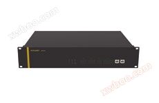
Urban Emergency Command System
Urban Emergency Command System
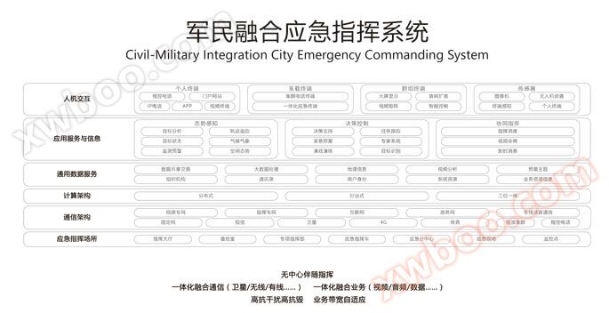
The integrated and unified communication command platform has the characteristics of universal platform design, intelligent business processing, service-oriented functional guarantee, and flat architecture deployment. It solves the problems of poor compatibility and interoperability among many systems in the command system, weak resistance to destruction of tree architecture, inflexibility of business organization application, and inconvenient dynamic network adjustment. It meets the requirements of emergency command, combat readiness duty, training exercises, and situational monitoring.
Integrated decision-making fusion: hierarchical command, adaptable to low bandwidth wartime communication mode, domain login, accompanying command mode, temporary group combat mode, a three in one command system, building target analysis, situation prediction and simulation capabilities in complex environments, supporting rule-based model self optimization, and providing strong support for decision-making.
Integrated business integration: Large screen 3D GIS comprehensive presentation, effective integration of geographic space and cyberspace, time series evolution, real-time integration of command and situation, with the functions of situation system implementation, calling terminals, and situation graphic push, achieving "instant viewing, instant calling, instant access".
Integrated Information Data Fusion: Provides standardized interfaces for integration with military and civilian command systems, supports data fusion and information cross-linking, joint command, real-time exchange of multiple services, integrated communication, and mixed exchange and transmission of voice, video, text, and data.
Integrated resource integration: an integrated system that integrates spatial situation, satellite radar sonar, meteorological information, friendly or enemy equipment, video command, public opinion, and prediction. It presents in multiple ways through computers and mobile terminals, achieving comprehensive acquisition, integrated processing, unified distribution, and on-demand display of all element resource information.
Integrated network integration: cloud service architecture, big data platform, unified platform, with data as the center, to achieve fully adaptive transmission of fixed network, satellite network, 4G network and other network channel carrying and switching.
| Command business | Basic command, contingency command and on-site command, roaming command, accompanying command, multi group command, subordinate and assigned command, video conferencing, video surveillance | |
| control system | Command Hall Chief Duty Staff Linkage Control System, Seat Display Control Centralized Management System | |
| Monitoring business | Integrated video surveillance system, security warning and alarm system, video analysis, personnel identification, vehicle identification system, etc | |
| Operation and maintenance functions | System operation monitoring, abnormal warning and positioning; Automatic equipment inspection and intelligent troubleshooting; Business operation monitoring, important task guarantee; Graphic user interface, easy to operate and use | |
Topology Map
system requirements
Reason for selection
Similar Product Recommend