-
E-mail
atlasinfo@atlasinfo.com.cn
- Phone
-
Address
Room 701, Guanhui Building, Building 3, No. 30 Shixing Street, Shijingshan District, Beijing
Product Categories
Beijing Atlas Information Technology Co., Ltd
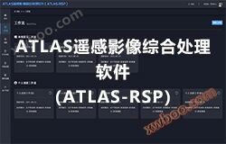
ATLAS Remote Sensing Image Comprehensive Processing Software (ATLAS-RSP)
NegotiableUpdate on 09/19
- Model
- Nature of the Manufacturer
- Producers
- Product Category
- Place of Origin
Overview
1、 The product introduction platform adopts a web based approach, with fast and simple operation and intuitive interface. The operation and use are simple and clear
Product Details
1、 Product Introduction
The platform adopts a web based approach, with fast and simple operations and an intuitive interface, making the operation and use straightforward and lively. Powerful classification statistics: The system can classify and query according to various conditions, and can real-time grasp the progress and work status of tasks. In terms of data, it can receive and process various domestic and foreign medium to high resolution remote sensing images, quickly generate various data processing products and remote sensing interpretation products; The platform has established a standardized and standardized production process for massive image data, while also building a comprehensive quality control system throughout the entire process. It is a highly automated and easy-to-use remote sensing data processing application platform.


2、 Software Features
- Multi scenario applicability, higher compatibility
The web end is more convenient for customers to use, firstly because it is easy to operate and master, and more importantly, it can comprehensively grasp the task management of production planning in real time, continuously improving the user experience of the application.
- Multivariate data processing
Supporting multiple data sources both domestically and internationally, it can meet the requirements of geometric precision correction, registration, fusion, and tiling. Using DEM and physical models for orthorectified high-resolution remote sensing data.
- Visual processing task design
Support visual configuration of data processing tasks and monitoring of data production status; Comprehensive operation monitoring and system monitoring, complete log tracking to ensure system stability.
- High degree of customization and flexible functionality
The degree of customization is high, and new features can be developed according to customer needs. The image production function supports user-defined running process settings. Compared to traditional image processing software, it appears more flexible.
- Capable of multitasking parallel computing
Based on CPU/GPU to achieve full process parallel processing capability, it solves the problems of slow processing and low production efficiency of massive remote sensing data.
- Rich data processing modules
Regional network adjustment module, DOM production module, DSM production module, task management module, role management module, performance monitoring module. Only one platform is needed to provide users with a series of functions, including data access, data integration and processing, data management, data analysis and application.
Similar Product Recommend