-
E-mail
513605359@qq.com
-
Phone
18320930025
-
Address
908-911, Building 6, SEG New City, Sanlian Community, Jihua Street, Longgang District, Shenzhen Pengjin Technology Co., Ltd
Product Categories
Shenzhen Pengjin Technology Co., Ltd


Ten Spectral RedEdge PDual - Professional Remote Sensing Camera
NegotiableUpdate on 11/20
- Model
- Nature of the Manufacturer
- Producers
- Product Category
- Place of Origin
Overview
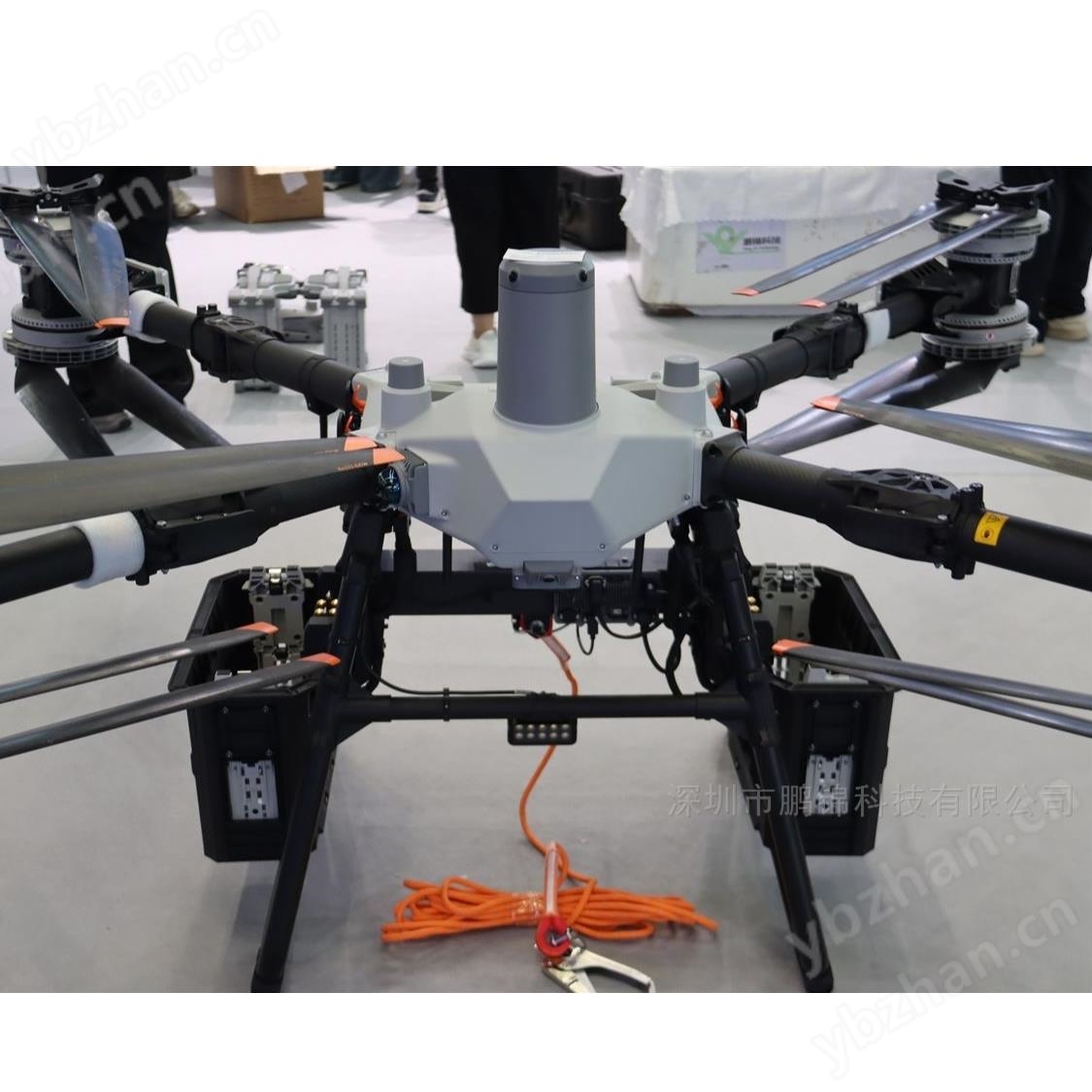
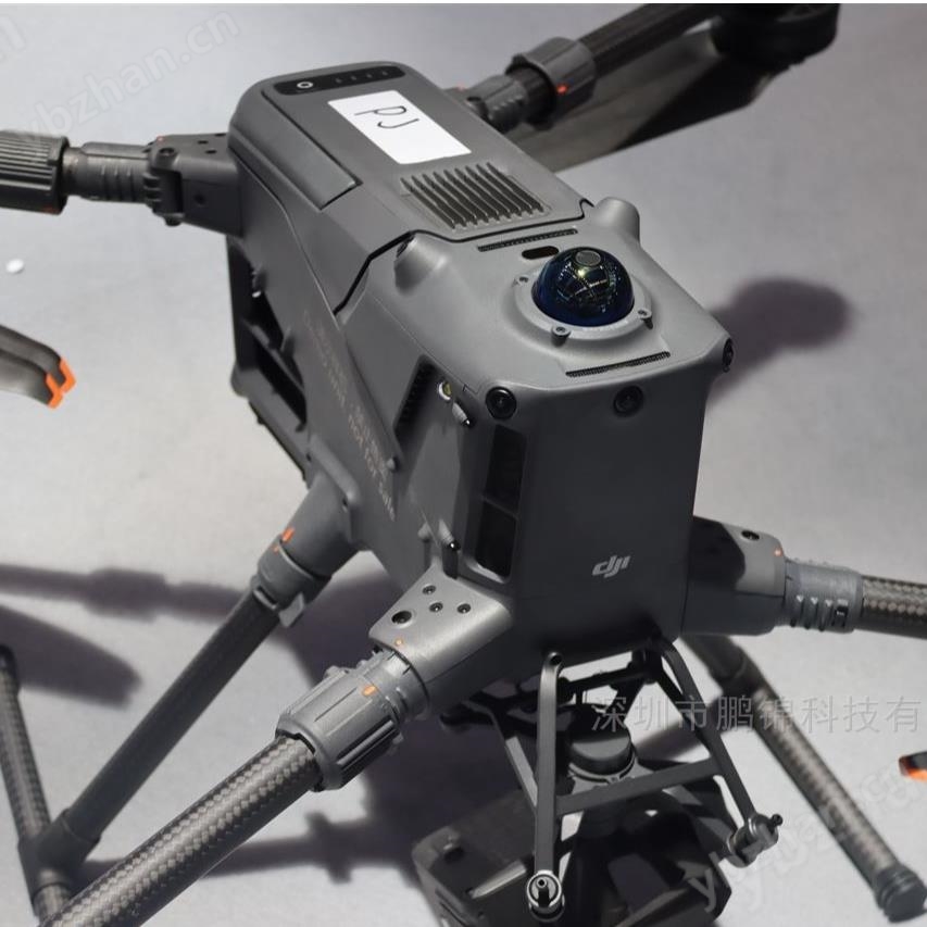
Ten Spectral RedEdge PDual - Professional remote sensing camera with two sensors. 10 bands. Used to enhance data comparison with satellites. $r $n is a high-resolution multispectral and RGB composite unmanned aerial vehicle sensor used for plant classification, weed identification, environmental research and protection, and water vegetation analysis.
Product Details
Ten Spectral RedEdge PDual - Professional Remote Sensing Camera
RedEdge-P dual camera system;
High resolution multispectral and RGB synthesized unmanned aerial vehicle mounted sensors
Two cameras, 10 spectra
RedEdge-P dual cameras obtain enhanced data that can be compared with satellites
RedEege-P Blue highlights:
5 spectral bands and 1 panchromatic band
Enhanced CFexpress memory card as standard storage
Global shutter can obtain distortion free images on any platform
Wireless WiFi
DLS2 has built-in GPS
RedEdge-P-Dual Product Technical Parameters:
Weight:745 grams/26.2 ounces (two sensors, installation hardware, DLS2, and cable)
Size:13.2 cm x 8.8 cm x 9.67 cm to 5.1 inches x 3.1 inches x 3.5 inches
External power supply:11/14.0/20W (standby, average, peak)
Spectral bands:Coastal Blue 444 (28) *, Blue 475 (32), Green 531 (14) *, Green 560 (27), Red 650 (16) *, Red 668 (14)
output:RGB 5.1 MP * * (global shutter, aligned with all bands)
Sensor resolution:1456 x 1088 (1.6 MP per multispectral band, 2464 x 2056 (5.1 MP panchromatic band) at 120 m/400 feet, 7.7 cm/3 inches per pixel (per multispectral band) at 120 m/40 feet, 3.98 cm/1.5 inches (panchromatic band) at high altitude
Ground sampling distance:3 more original DNG images per second
Interface:Three compatible GPIO,Select from trigger input, PPS input, PPS output, and frame top signal. Host virtual button. USB 2.0 port for WiFi. TV series on 10/100/1000 Ethernet.
External power supply:7.0 V - 25.2 V
view:50 ° HFOV x 38 ° VFOV (multispectral), 44 ° HFOV x 38 ° VFOV (panchromatic) field of view
temperatureNo airflow environment: 0-40 ° C/0-104 ° F airflow>0.5 meters/second/>1.1 miles/hour environment: 0-50 ° C/0-122 ° F
Protection level:IP4XProduct Features:
1. Synchronize capture of all 10 frequency bands to obtain pixel aligned images
2. Standard 12 bit TIFF file output with embedded metadata, where the raw data can be accessed
3. Simplified integration of downlink light sensors and GPS combination, precise ambient light calibration. Only one DLSo is required
4. A radiation calibrated spectral imaging instrument used for precise and reproducible measurements.
5. All 10 lenses are equipped with a global shutter to achieve distortion free effects on each platform.
6. The standard configuration includes a fixed bracket and quick installation connector, which can be easily integrated with DJI drones
Weed detection

Thistle (pink) and wild mustard (light green)
Weeds in the green mint field
Image classification

Monitoring Algae

RGB Composite

Ten Spectral RedEdge PDual - Professional Remote Sensing Camera
Similar Product Recommend